Sandersville, Georgia
Sandersville, Georgia | |
|---|---|
City | |
| Nickname(s): Kaolin Capital of the World | |
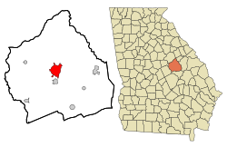 Location in Washington County and the state of Georgia | |
| Coordinates: 32°58′55″N 82°48′35″W / 32.98194°N 82.80972°W / 32.98194; -82.80972Coordinates: 32°58′55″N 82°48′35″W / 32.98194°N 82.80972°W / 32.98194; -82.80972 | |
| Country | United States |
| State | Georgia |
| County | Washington |
| Founded | 1796 |
| Incorporated | 1812 |
| Government | |
| • Type | Council-Mayor |
| • Mayor | James W. Andrews |
| Area | |
| • Total | 9.2 sq mi (23.9 km2) |
| • Land | 9.1 sq mi (23.7 km2) |
| • Water | 0.1 sq mi (0.2 km2) |
| Elevation | 446 ft (136 m) |
| Population (2010) | |
| • Total | 5,912 |
| • Estimate (2016)[3] | 5,700 |
| • Density | 670/sq mi (257/km2) |
| Time zone | UTC-5 (Eastern (EST)) |
| • Summer (DST) | UTC-4 (EDT) |
| ZIP code | 31082 |
| Area code(s) | 478 Exchanges: 240,552,553 |
| FIPS code | 13-68208[1] |
GNIS feature ID | 0322445[2] |
| Website | www.sandersville.net |
The city of Sandersville is the county seat[4] of Washington County, Georgia, United States. The population was 5,912 at the 2010 census. It is also a part of the Central Savannah River Area.
Sandersville is known as the "Kaolin Capital of the World" due to its abundance of kaolin.[5]
Contents
1 Geography
2 Demographics
3 History
4 Economy
5 Education
5.1 Washington County School District
5.2 Private education
5.3 Higher education
6 Media
6.1 Newspaper
7 Notable people
8 See also
9 References
10 External links
Geography
According to the United States Census Bureau, the city has a total area of 10.45 square kilometres (4.03 sq mi), of which 9.1 square miles (24 km2) is land and 0.1 square miles (0.26 km2) (0.87%) is water. The area is along the "Fall Line" that separates the Piedmont Plateau and the Atlantic Coastal Plain and is characterized by rolling hills, red clay, pine and hardwood forest, swamplands, and sand beds. The area tapers off from North to South and becomes more flat. Heading north it becomes more hilly with higher elevations.
Demographics
| Historical population | |||
|---|---|---|---|
| Census | Pop. | %± | |
| 1880 | 1,279 | — | |
| 1890 | 1,760 | 37.6% | |
| 1900 | 2,023 | 14.9% | |
| 1910 | 2,641 | 30.5% | |
| 1920 | 2,695 | 2.0% | |
| 1930 | 3,011 | 11.7% | |
| 1940 | 3,566 | 18.4% | |
| 1950 | 4,480 | 25.6% | |
| 1960 | 5,425 | 21.1% | |
| 1970 | 5,546 | 2.2% | |
| 1980 | 6,137 | 10.7% | |
| 1990 | 6,290 | 2.5% | |
| 2000 | 6,144 | −2.3% | |
| 2010 | 5,912 | −3.8% | |
| Est. 2016 | 5,700 | [3] | −3.6% |
| U.S. Decennial Census[6] | |||
As of the census[1] of 2011, there were 6,097 people, 2,315 households, and 1,568 families residing in the city. The population density was 672.1 people per square mile (259.5/km²). There were 2,566 housing units at an average density of 283.2 per square mile (109.4/km²). The racial makeup of the city was 59.03% African American, 39.76% White, 0.11% Native American, 0.60% Asian, 0.05% Pacific Islander, 0.03% from other races, and 0.41% from two or more races. Hispanic or Latino of any race were 0.24% of the population.
There were 2,362 households out of which 31.8% had children under the age of 18 living with them, 37.2% were married couples living together, 25.8% had a female householder with no husband present, and 32.6% were non-families. 30.0% of all households were made up of individuals and 13.3% had someone living alone who was 65 years of age or older. The average household size was 2.52 and the average family size was 3.13.
In the city, the population was spread out with 28.0% under the age of 18, 7.8% from 18 to 24, 26.5% from 25 to 44, 21.8% from 45 to 64, and 15.9% who were 65 years of age or older. The median age was 37 years. For every 100 females, there were 79.6 males. For every 100 females age 18 and over, there were 72.4 males.
The median income for a household in the city was $27,201, and the median income for a family was $32,462. Males had a median income of $36,089 versus $21,765 for females. The per capita income for the city was $18,226. About 24.3% of families and 27.5% of the population were below the poverty line, including 36.2% of those under age 18 and 24.1% of those age 65 or over.
History
The city's original name was Saundersville, after M. Saunders, a local store owner. The settlement was located at an intersection of Native American Indian trails, and later the site of Saunders' general store. In 1796, the town was made the county seat of Washington County.[7]
In 1864, during the Civil War, General William T. Sherman skirmished and then paused in Sandersville during his March to the Sea. Brief resistance to the advancing Union forces was centered on the courthouse. As they left, Sherman's troops burned both it and jail, but left the rest of the town intact.[8] A new Washington County Courthouse was built in 1869.
The Sandersville Railroad was built in 1893 as a part of the Central of Georgia Railway, but still operates today as a private owned shortline that connects to Norfolk Southern Railway's Georgia Division Savannah District at Tennille, Georgia 4 miles to the South.
Economy
The economy of Sandersville was based on agriculture, particularly cotton, for many years. In the 1950s, an industry developed based on the mining and processing of kaolin found in the area.[8]
Education
Washington County School District
The Washington County School District holds pre-school to grade twelve, and consists of a primary and elementary school, a middle school, and a high school.[9] The district has 220 full-time teachers and over 3,821 students.[10]
- Ridge Road Primary School
- Ridge Road Elementary School
- T. J. Elder Middle School
- Washington County High School
Private education
Brentwood School (grades K-3 through 12)
Higher education
Oconee Fall Line Technical College- Main Campus [ North Campus ]
Georgia Military College- Extension Centre[11]
Darton State College Division of Nursing offers a Nursing associate degree program[12]
Media
Newspaper
Sandersville has two newspapers: The Sandersville Progress and "The Spotlight". They both are published weekly. The Sandersville Progress began publication in 1870.
Notable people
- Richard Brown, Jr., gospel musician
Nathan Deal, 82nd Governor of Georgia
Doris Duke, soul singer
Robert Edwards, professional football player[13]
Terrence Edwards, professional football player[14]
Thomas W. Hardwick, lawyer and 63rd Governor of Georgia
Herbert Jefferson, Jr., actor
Marvin Lane, professional baseball player[15]
Greg Minor, professional basketball player [16]
Elijah Muhammad, Leader of the Nation of Islam[17]
Takeo Spikes, professional football player[18]
Coot Veal, professional baseball player[19]
See also
- Central Savannah River Area
References
^ ab "American FactFinder". United States Census Bureau. Retrieved 2008-01-31..mw-parser-output cite.citation{font-style:inherit}.mw-parser-output .citation q{quotes:"""""""'""'"}.mw-parser-output .citation .cs1-lock-free a{background:url("//upload.wikimedia.org/wikipedia/commons/thumb/6/65/Lock-green.svg/9px-Lock-green.svg.png")no-repeat;background-position:right .1em center}.mw-parser-output .citation .cs1-lock-limited a,.mw-parser-output .citation .cs1-lock-registration a{background:url("//upload.wikimedia.org/wikipedia/commons/thumb/d/d6/Lock-gray-alt-2.svg/9px-Lock-gray-alt-2.svg.png")no-repeat;background-position:right .1em center}.mw-parser-output .citation .cs1-lock-subscription a{background:url("//upload.wikimedia.org/wikipedia/commons/thumb/a/aa/Lock-red-alt-2.svg/9px-Lock-red-alt-2.svg.png")no-repeat;background-position:right .1em center}.mw-parser-output .cs1-subscription,.mw-parser-output .cs1-registration{color:#555}.mw-parser-output .cs1-subscription span,.mw-parser-output .cs1-registration span{border-bottom:1px dotted;cursor:help}.mw-parser-output .cs1-ws-icon a{background:url("//upload.wikimedia.org/wikipedia/commons/thumb/4/4c/Wikisource-logo.svg/12px-Wikisource-logo.svg.png")no-repeat;background-position:right .1em center}.mw-parser-output code.cs1-code{color:inherit;background:inherit;border:inherit;padding:inherit}.mw-parser-output .cs1-hidden-error{display:none;font-size:100%}.mw-parser-output .cs1-visible-error{font-size:100%}.mw-parser-output .cs1-maint{display:none;color:#33aa33;margin-left:0.3em}.mw-parser-output .cs1-subscription,.mw-parser-output .cs1-registration,.mw-parser-output .cs1-format{font-size:95%}.mw-parser-output .cs1-kern-left,.mw-parser-output .cs1-kern-wl-left{padding-left:0.2em}.mw-parser-output .cs1-kern-right,.mw-parser-output .cs1-kern-wl-right{padding-right:0.2em}
^ "US Board on Geographic Names". United States Geological Survey. 2007-10-25. Retrieved 2008-01-31.
^ ab "Population and Housing Unit Estimates". Retrieved June 9, 2017.
^ "Find a County". National Association of Counties. Retrieved 2011-06-07.
^ "Kaolin Capital of the World". City of Sandersville, GA. Retrieved 27 August 2018.
^ "Census of Population and Housing". Census.gov. Retrieved June 4, 2015.
^ State of Georgia. "City of Sandersville". Retrieved 1 September 2009.
^ ab Hollingsworth, Brenda. "Washington County". Retrieved 1 September 2009.
^ Georgia Board of Education, Retrieved June 29, 2010.
^ School Stats, Retrieved June 29, 2010.
^ Georgia Military College- Campus Locations, Retrieved June 29, 2010
^ "Healthcare Professional to RN Bridge - Sandersville". Darton State College Division of Nursing. Retrieved August 13, 2014.
^ "Robert Edwards". nfl.com. Retrieved 2013-05-13.
^ "Terrence Edwards". nfl.com. Retrieved 2013-05-13.
^ "Marvin Lane Baseball Stats by Baseball Almanac". www.baseball-almanac.com. Retrieved 2010-01-23.
^ "Greg Minor NBA & ABA Statistics". www.basketball-reference.com. Retrieved 2010-01-23.
^ http://www.noi.org/hon-elijah-muhammad/
^ "Takeo Spikes". nfl.com. Retrieved 2010-01-23.
^ "Coot Veal Statistics and History - Baseball-Reference.com". www.baseball-reference.com. Retrieved 2010-01-23.
External links
- Official website for the City of Sandersville
- Sandersville page on Georgia.gov
- Official website for the Washington County Board of Education
Municipalities and communities of Washington County, Georgia, United States | ||
|---|---|---|
County seat: Sandersville | ||
| Cities |
|  |
| Towns |
| |
| Unincorporated communities |
| |


