莫氏樹蛙
| 莫氏樹蛙 | |
|---|---|
 | |
保护状况 | |
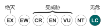 无危(IUCN 3.1)[1] | |
科学分类 | |
| 界: | 动物界 Animalia |
| 门: | 脊索动物门 Chordata |
| 纲: | 两栖纲 Amphibia |
| 目: | 无尾目 Anura |
| 科: | 樹蛙科 Rhacophoridae |
| 属: | 樹蛙屬 Rhacophorus |
种: | 莫氏樹蛙 R. moltrechti |
二名法 | |
Rhacophorus moltrechti Boulenger, 1803 | |
異名[2] | |
Rhacophorus schlegelii moltrechti — Wolf, 1936 | |
莫氏樹蛙(学名:Rhacophorus moltrechti)是台灣淺山地區最常見的綠色樹蛙,分布也最廣泛,成體的大小約4-5公分。别名台湾树蛙,是台灣特有物种[3]。
目录
1 描述
2 棲地
3 保育
4 参考文献
描述
莫氏樹蛙是一種中型大小的樹蛙,雌蛙體長為 5~6 cm(2.0~2.4英寸) ;雄蛙略小約[4] 3.6~4.2 cm(1.4~1.7英寸)[5]。趾尖有發展完善的盤狀物。皮膚光滑,整體外觀為綠色;少數個體有些許白點。腹部為黃白色。後腿隱藏面的皮膚為紅色或橙色,帶有黑色斑點。虹膜是橙紅色。[4]
棲地
莫氏樹蛙棲息於海拔高度 3,000米(9,800英尺)以下的森林,果園和茶園[4][1]。繁殖於不流動水域,如池塘,水池,蓄水池和封閉的路邊溝渠中[1][6]。它也可能在間歇性溪流,坑洼和溪流池中繁殖[1]。高海拔 (~2,000米(6,600英尺)) 族群繁殖於春季和夏季(4月至9月),而低海拔 (<500米(1,600英尺)) 族群為深秋到早春(10月至3月);中等海拔族群則全年繁殖,春季為高峰期。卵產於水面上的泡沫巢中,附著在樹枝、灌木叢或牆壁上。[6]
歸納文獻上的記載,大致上來說,台灣中央山脈西部(中北部)的莫氏樹蛙是春夏兩季,而中央山脈東部的繁殖季則在秋冬兩季,似乎與季風帶來的雨水有相關聯,而屏東泰武的紀錄則是秋冬,又不太符合上述的歸納。(屏東泰武鄉在中央山脈以西)。
保育
莫氏樹蛙是一種常見且適應性強的物種,未面臨重大威脅。在幾個保護區皆有發現其蹤跡。[1]
由於樹蛙科的兩棲類對於棲息地的變化敏感,所有的樹蛙幾乎都列名台灣保育類的動物名錄中,而大規模的棲息環境變動也幾乎造成蛙類滅絕的大禍而不自知。
参考文献
^ 1.01.11.21.31.4 Lue Kuangyang & Chou Wenhao. Rhacophorus moltrechti. The IUCN Red List of Threatened Species (IUCN). 2004, 2004: e.T59005A11866212 [15 January 2018]. doi:10.2305/IUCN.UK.2004.RLTS.T59005A11866212.en.
^ Frost, Darrel R. Rhacophorus moltrechti Boulenger, 1908. Amphibian Species of the World: an Online Reference. Version 6.0. American Museum of Natural History. 2018 [5 October 2018].
^ 中国科学院动物研究所. 台湾树蛙. 《中国动物物种编目数据库》. 中国科学院微生物研究所. [2009-04-11]. (原始内容存档于2016-03-05).
^ 4.04.14.2 Lue, Kuang-Yang. Rhacophorus moltrechti. BiotaTaiwanica. 2011 [16 August 2012]. (原始内容存档于4 March 2016).
^ Lue, Kuang-Yang; Lai, June-Shiang & Chen, Szu-Lung. A new species of Rhacophorus (Anura: Rhacophoridae) from Taiwan. Herpetologica. 1994, 50 (3): 303–308. JSTOR 3892703.
^ 6.06.1 Chang, Y.-M.; Tseng, W.-H.; Chen, C.-C.; Huang, C.-H.; Chen, Y.-F. & Hatch, K. A. Winter breeding and high tadpole densities may benefit the growth and development of tadpoles in a subtropical lowland treefrog. Journal of Zoology. 2014, 294 (3): 154–160. doi:10.1111/jzo.12162.
|


