田原市
body.skin-minerva .mw-parser-output table.infobox caption{text-align:center}
田原市 田原市 | |||
|---|---|---|---|
| 日文轉寫 | |||
| • 日文 | 田原市 | ||
| • 平假名 | たはらし | ||
| • 罗马字 | Tahara-shi | ||
 伊良湖岬頂端的伊良湖岬燈塔 | |||
| |||
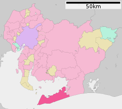 田原市在愛知縣的位置 | |||
 田原市 田原市在日本的位置 | |||
坐标:34°40′N 137°16′E / 34.67°N 137.27°E / 34.67; 137.27 | |||
| 国家 | |||
| 地方 | 中部地方 | ||
| 都道府縣 | 愛知縣 | ||
| 接鄰行政區 | 豐橋市 | ||
| 面积 | |||
| • 总计 | 188.58 平方公里(72.81 平方英里) | ||
| 人口(2007年8月31日) | |||
| • 總計 | 66,769 | ||
| 时区 | 日本標準時間 (UTC+9) | ||
| 地方公共團體編號 | 23231-9 | ||
| 邮政编码 | 〒441-3492 | ||
| 市役所地址 | 田原市田原町南番場30-1 | ||
| 電話號碼 | +81-531-22-4111 | ||
| 法人編號 | 7000020232319 | ||
| 網站 | www.city.tahara.aichi.jp | ||


田原市(日语:田原市/たはらし Tahara shi */?)是愛知縣南部,渥美半島上的市。

太平洋長灘

伊良湖岬

伊良湖岬燈塔附近的海濱大道

戀愛海濱

田原市蘆葦池塘農業公園
維基導遊上的相關旅行指南:田原市(英文) |
维基共享资源中相关的多媒体资源:田原市 |
| ||||||||||||||||||||||||||||||||||||||||


|


