罗图马
body.skin-minerva .mw-parser-output table.infobox caption{text-align:center}
罗图马 Rotuma | |
|---|---|
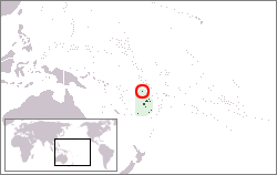 罗图马在美拉尼西亚的位置 | |
 罗图马岛地图 | |
| 行政中心 | 阿豪 |
| 官方语言 |
|
族群 |
|
| 政府 | |
• 地区长官 | Niumaia Masere |
• 罗图马委员会主席 | Tarterani Rigamoto |
| 独立 脱离英国,成为斐济的一部分 | |
• 日期 | 1970年10月10日 |
| 面积 | |
• 总计 | 46 km2 |
| 人口 | |
• 2007年普查 | 2002 |
| 货币 | 斐济元(FJD) |
| 时区 | UTC+12 |
| 电话区号 | +679 |
罗图马(斐濟語:Rotuma)是斐济的一个属地(Dependency),由罗图马岛和附近小岛组成。面积46平方公里,人口2,002人(2007年统计)。
目录
1 地理
2 历史
3 交通
4 参考文献
地理
罗图马岛约13公里长,4公里宽。在岛的东部与西部半岛之间有一个约230米宽的地峡。罗图马岛是由一个盾状火山形成的岛屿。
历史
根据口述历史,罗图马岛最早的居民来自萨摩亚。
1791年,欧洲人首次登陆罗图马岛。
交通
- 罗图马机场
参考文献
Islands of Fiji, Island Directory, United Nations Environment Programme
| ||||||||||||||||||||||


