乌东德水电站
body.skin-minerva .mw-parser-output table.infobox caption{text-align:center}
| 乌东德水电站 | |
|---|---|
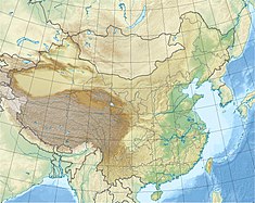 乌东德水电站在中國的位置 | |
| 位置 | 四川会东-云南禄劝 |
| 开始建设 | 2014 |
| 啟用日期 | 2020 |
| 持有者 | 中国长江三峡集团公司 |
| 水坝和溢洪道 | |
| 水坝类型 | 拱坝 |
| 橫跨 | 金沙江 |
| 高度 | 240米(790英尺) |
| 水库 | |
| 总容量 | 7,600,000,000立方米(6,200,000英畝·英尺) |
| 发电站 | |
| 運作日期 | 2018-2020(预计) |
| 涡轮机 | 12 × 850 MW 混流式水轮机 |
| 裝機容量 | 10,200 MW |
乌东德水电站是中国西南一座建设中的大型水电站,位于四川省会东县与云南省禄劝县交界的金沙江干流上,是金沙江下游的特大型水利工程,以发电为主,兼有防洪、拦沙和改善下游航运条件等综合效益,建成后将是中国装机容量第四大水电站。
乌东德水电站是金沙江下游河段开发规划4个梯级电站中的第1级,在金沙江水电基地中规模第三,小于溪洛渡水电站和白鹤滩水电站。工程采用混凝土双曲拱坝,坝高270米,正常蓄水位975米,总库容76亿立方米,调节库容26亿立方米,总装机容量1020万千瓦,单台机组为85万千瓦,左右岸各6台。年平均发电量394.6亿度,工程静态投资336亿元。[1]
乌东德水电站是西电东送重要项目之一,满足华东、华中经济发展的用电需求;配合三峡工程提高长江中下游的防洪能力,充分发挥三峡工程的综合效益。
乌东德水电站所在地人口密度较低,单位装机容量搬迁安置人口要远远低于三峡水电站。工程建设征地总面积138.65平方公里,规划搬迁安置人口32182人。
参见
- 世界水电站列表
- 中华人民共和国水电站列表
- 中国最高水坝列表
- 白鹤滩水电站
参考文献
^ 乌东德水电站. 中国长江三峡集团公司. 2007-01-05. (原始内容存档于2015-04-02).
| |||||||


