Binmaley, Pangasinan
Binmaley | ||
|---|---|---|
Municipality | ||
| Municipality of Binmaley | ||
 | ||
| ||
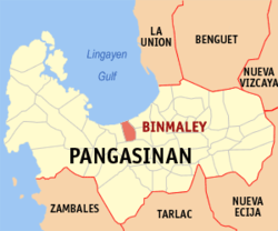 Map of Pangasinan with Binmaley highlighted | ||
 Binmaley Location within the Philippines | ||
| Coordinates: 16°01′57″N 120°16′16″E / 16.0325°N 120.27111°E / 16.0325; 120.27111Coordinates: 16°01′57″N 120°16′16″E / 16.0325°N 120.27111°E / 16.0325; 120.27111 | ||
| Country | ||
| Region | Ilocos Region (Region I) | |
| Province | Pangasinan | |
| District | 2nd district of Pangasinan | |
| Founded | February 1, 1590 | |
| Barangays | 33 (see Barangays) | |
| Government [1] | ||
| • Type | Sangguniang Bayan | |
| • Mayor | Simplicio Rosario | |
| • Vice Mayor | Edgar Mamenta | |
| • Electorate | 55,280 voters (2016) | |
| Area [2] | ||
| • Total | 118.50 km2 (45.75 sq mi) | |
| Population (2015 census)[3] | ||
| • Total | 83,052 | |
| • Density | 700/km2 (1,800/sq mi) | |
| Time zone | UTC+8 (PST) | |
| ZIP code | 2417 | |
| PSGC | 015513000 | |
| IDD : area code | +63 (0)75 | |
| Climate type | Tropical monsoon climate | |
| Income class | 1st municipal income class | |
| Revenue (₱) | 160,401,850.71 (2016)[4] | |
| Poverty incidence | 7.45 (2012)[5] | |
| Native languages | Pangasinan Ilocano Tagalog | |

Binmaley, officially the Municipality of Binmaley, (Pangasinan: Baley na Binmaley; Ilokano: Ili ti Binmaley; Tagalog: Bayan ng Binmaley), is a 1st class municipality in the province of Pangasinan, Philippines. According to the 2015 census, it has a population of 83,052 people.[3]
Binmaley is located along the western coastland of Pangasinan facing the Lingayen Gulf, in between Lingayen and Dagupan City. On January 8–9, 1945, the amphibious forces of U.S. General Douglas MacArthur used the town's beach, designated as "yellow beach", alongside the beaches of Lingayen, Dagupan, and San Fabian, in their landing operations to liberate Luzon from Japanese occupation during World War II.
The town is famous for its bangus (milkfish) aqua-culture, due to the existence of its numerous fishponds (pokok in the Pangasinan language). However, because of constant siltation over the past several years from mine tailings upstream from Agno River (due to mine operations in neighboring Benguet Province), and the overuse of artificial fish feeds, the bangus industry has suffered from fishkill, fewer viable fishponds and lower harvests. As a result, many formerly productive fishponds have been converted into large commercial and residential lots. This phenomenon is beginning to seriously threaten the unique Binmaley fishpond industry. Current Government action is inadequate due to strong pressures from other competing commercial interests, not to mention fishfeed producers.
Binmaley's town center has a Neo classical church dating back to the 17th century. It also became famous throughout the Philippines for the outstanding academic achievements of students (and its distinctive corps of military cadets) from its Binmaley Catholic High School, especially when it was headed by a German priest, Fr. Leo Behneke, in the 1960s and 1970s. Its name roughly means "the place which became a town" or "went to town" in the Pangasinan language.
Binmaley, is famously known for its "Sigay Festival". The Pangasinan word sigay broadly translates to harvest, or a time to gather the rich yields of the farm, the sea, the ponds and the rivers. It also relates to a contraction of the words silew, meaning light, and gayaga, meaning merriment. It was Mayor Lorenzo "Enzo" Cerezo who pioneered and founded "Sigay Festival".
Contents
1 Barangays
2 Heritage
3 Demographics
4 Climate
5 Images
6 References
7 External links
Barangays
Binmaley is politically subdivided into 33 barangays.
- Amancoro
- Balagan
- Balogo
- Basing
- Baybay Lopez
- Baybay Polong
- Biec
- Buenlag
- Calit
- Caloocan Dupo
- Caloocan Norte
- Caloocan Sur
- Camaley
- Canaoalan
- Dulag
- Gayaman
- Linoc
- Lomboy
- Nagpalangan
- Malindong
- Manat
- Naguilayan
- Pallas
- Papagueyan
- Parayao
- Poblacion
- Pototan
- Sabangan
- Salapingao
- San Isidro Norte
- San Isidro Sur
- Santa Rosa
- Tombor
Heritage
Demographics
| Population census of Binmaley | ||
|---|---|---|
| Year | Pop. | ±% p.a. |
| 1903 | 16,439 | — |
| 1918 | 18,243 | +0.70% |
| 1939 | 20,455 | +0.55% |
| 1948 | 26,501 | +2.92% |
| 1960 | 32,127 | +1.62% |
| 1970 | 40,645 | +2.38% |
| 1975 | 43,543 | +1.39% |
| 1980 | 47,332 | +1.68% |
| 1990 | 59,601 | +2.33% |
| 1995 | 62,375 | +0.86% |
| 2000 | 72,625 | +3.32% |
| 2007 | 76,214 | +0.67% |
| 2010 | 78,702 | +1.18% |
| 2015 | 83,052 | +1.03% |
| Source: Philippine Statistics Authority[3][6][7][8] | ||
Climate
| Climate data for Binmaley, Pangasinan | |||||||||||||
|---|---|---|---|---|---|---|---|---|---|---|---|---|---|
| Month | Jan | Feb | Mar | Apr | May | Jun | Jul | Aug | Sep | Oct | Nov | Dec | Year |
| Average high °C (°F) | 31 (88) | 31 (88) | 33 (91) | 34 (93) | 34 (93) | 33 (91) | 32 (90) | 31 (88) | 31 (88) | 32 (90) | 31 (88) | 31 (88) | 32 (90) |
| Average low °C (°F) | 21 (70) | 21 (70) | 23 (73) | 25 (77) | 25 (77) | 25 (77) | 25 (77) | 24 (75) | 24 (75) | 24 (75) | 23 (73) | 22 (72) | 24 (74) |
| Average precipitation mm (inches) | 4.3 (0.17) | 19.1 (0.75) | 27.3 (1.07) | 45.2 (1.78) | 153.3 (6.04) | 271.3 (10.68) | 411.1 (16.19) | 532 (20.9) | 364.4 (14.35) | 182.5 (7.19) | 56.3 (2.22) | 24.4 (0.96) | 2,091.2 (82.3) |
| Average rainy days | 3 | 2 | 3 | 5 | 14 | 17 | 22 | 23 | 21 | 13 | 7 | 4 | 134 |
| Source: World Weather Online[9] | |||||||||||||
Images
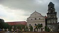
The Our Lady of the Purification Parish Church

Binmaley Museum

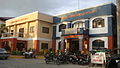
Binmaley Presidencia [1]
Bulwagan ng Sangguniang Bayan at Himpilan ng Pambansang Kapulisan
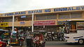
Pamilihang Bayan ng Binmaley
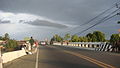
Manat river & Gumapos Bridge


References
^ "Municipality". Quezon City, Philippines: Department of the Interior and Local Government. Retrieved 31 May 2013..mw-parser-output cite.citation{font-style:inherit}.mw-parser-output q{quotes:"""""""'""'"}.mw-parser-output code.cs1-code{color:inherit;background:inherit;border:inherit;padding:inherit}.mw-parser-output .cs1-lock-free a{background:url("//upload.wikimedia.org/wikipedia/commons/thumb/6/65/Lock-green.svg/9px-Lock-green.svg.png")no-repeat;background-position:right .1em center}.mw-parser-output .cs1-lock-limited a,.mw-parser-output .cs1-lock-registration a{background:url("//upload.wikimedia.org/wikipedia/commons/thumb/d/d6/Lock-gray-alt-2.svg/9px-Lock-gray-alt-2.svg.png")no-repeat;background-position:right .1em center}.mw-parser-output .cs1-lock-subscription a{background:url("//upload.wikimedia.org/wikipedia/commons/thumb/a/aa/Lock-red-alt-2.svg/9px-Lock-red-alt-2.svg.png")no-repeat;background-position:right .1em center}.mw-parser-output .cs1-subscription,.mw-parser-output .cs1-registration{color:#555}.mw-parser-output .cs1-subscription span,.mw-parser-output .cs1-registration span{border-bottom:1px dotted;cursor:help}.mw-parser-output .cs1-hidden-error{display:none;font-size:100%}.mw-parser-output .cs1-visible-error{font-size:100%}.mw-parser-output .cs1-subscription,.mw-parser-output .cs1-registration,.mw-parser-output .cs1-format{font-size:95%}.mw-parser-output .cs1-kern-left,.mw-parser-output .cs1-kern-wl-left{padding-left:0.2em}.mw-parser-output .cs1-kern-right,.mw-parser-output .cs1-kern-wl-right{padding-right:0.2em}
^
"Province: Pangasinan". PSGC Interactive. Quezon City, Philippines: Philippine Statistics Authority. Retrieved 12 November 2016.
^ abc
Census of Population (2015). "Region I (Ilocos Region)". Total Population by Province, City, Municipality and Barangay. PSA. Retrieved 20 June 2016.
^ "Pangasinan : Cities and Municipalities Competitiveness Index". Makati City, Philippines: National Competitiveness Council (Philippines). Archived from the original on 28 January 2017. Retrieved 28 January 2017.
^ "PSA Releases the 2012 Municipal and City Level Poverty Estimates". Quezon City, Philippines: Philippine Statistics Authority. Archived from the original on 28 January 2017. Retrieved 28 January 2017.
^
Census of Population and Housing (2010). "Region I (Ilocos Region)". Total Population by Province, City, Municipality and Barangay. NSO. Retrieved 29 June 2016.
^
Censuses of Population (1903–2007). "Region I (Ilocos Region)". Table 1. Population Enumerated in Various Censuses by Province/Highly Urbanized City: 1903 to 2007. NSO.
^
"Province of Pangasinan". Municipality Population Data. Local Water Utilities Administration Research Division. Retrieved 17 December 2016.
^
"Binmaley, Pangasinan: Average Temperatures and Rainfall". World Weather Online. Retrieved 26 September 2015.
External links
| Wikimedia Commons has media related to Binmaley. |
- Municipal Profile at the National Competitiveness Council of the Philippines
- Binmaley at Pangasinan Government Website
- Local Governance Performance Management System
- Philippine Standard Geographic Code
- Philippine Census Information
- Pangasinan.org : Binmaley Family and School Reunion Archives
Places adjacent to Binmaley, Pangasinan | ||||||||||
|---|---|---|---|---|---|---|---|---|---|---|
| ||||||||||
Lingayen (capital) | |
| Municipalities |
|
| Component cities |
|
| Independent component city |
|
| Barangays | See: List of barangays in Pangasinan |


