Newberry County, South Carolina
Newberry County, South Carolina | |
|---|---|
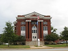 Newberry County Courthouse | |
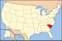
 Location in the U.S. state of South Carolina | |
 South Carolina's location in the U.S. | |
| Founded | 1785 |
| Seat | Newberry |
| Largest city | Newberry |
| Area | |
| • Total | 647 sq mi (1,676 km2) |
| • Land | 630 sq mi (1,632 km2) |
| • Water | 17 sq mi (44 km2), 2.7% |
| Population | |
| • (2010) | 37,508 |
| • Density | 60/sq mi (20/km2) |
| Congressional districts | 3rd, 5th |
| Time zone | Eastern: UTC−5/−4 |
| Website | http://www.newberrycounty.net/ |
Newberry County is a county located in the U.S. state of South Carolina. As of the 2010 census, its population was 37,508.[1] Its county seat is Newberry.[2] The name is of unknown origin.
Newberry County comprises the Newberry, SC Micropolitan Statistical Area
Contents
1 History
2 Geography
2.1 Adjacent counties
2.2 National protected area
3 Demographics
3.1 2000 census
3.2 2010 census
4 Infrastructure
5 Communities
5.1 Cities
5.2 Towns
5.3 Unincorporated communities
6 Politics
7 See also
8 References
9 External links
History
Newberry County was formed from Ninety-Six District in 1785. Prior to its formal founding, the area was the site of several American Revolutionary War battles: Williams' Plantation, Dec. 31, 1780; Mud Lick, March 2, 1781; and Bush River, May 1781.[3]The town of Newberry was founded in 1789 as the county seat and was sometimes called Newberry Courthouse for that reason.
Originally settled by yeomen farmers, in the nineteenth century numerous plantations were established for the cultivation of short-staple cotton. Its processing had been made profitable by invention of the cotton gin. Cotton was the primary crop grown in Newberry County before the American Civil War. Newberry was a trading town, and expanded with the arrival of the railroad in the early 1850s, which connected it to major towns and markets. Newberry College was established by the Lutheran Church in 1856.
The Civil War interrupted growth in the county; the warfare and loss of lives of many southern men disrupted the state economy. The first cotton mills were constructed in the county in the 1880s, and quickly became an important part of the economy and a source of jobs. With the mechanization of agriculture in the early 20th century, labor needs were reduced.
Since the 1970s the population of Newberry County has been growing due to increasing local economic prosperity.
Geography
According to the U.S. Census Bureau, the county has a total area of 647 square miles (1,680 km2), of which 630 square miles (1,600 km2) is land and 17 square miles (44 km2) (2.7%) is water.[3]
Adjacent counties
Union County - north
Fairfield County - east
Lexington County - southeast
Richland County - southeast
Saluda County - south
Greenwood County - southwest
Laurens County - northwest
National protected area
Sumter National Forest (part)
Demographics
| Historical population | |||
|---|---|---|---|
| Census | Pop. | %± | |
| 1790 | 9,342 | — | |
| 1800 | 12,006 | 28.5% | |
| 1810 | 13,964 | 16.3% | |
| 1820 | 16,104 | 15.3% | |
| 1830 | 17,441 | 8.3% | |
| 1840 | 18,350 | 5.2% | |
| 1850 | 20,143 | 9.8% | |
| 1860 | 20,879 | 3.7% | |
| 1870 | 20,775 | −0.5% | |
| 1880 | 26,497 | 27.5% | |
| 1890 | 26,434 | −0.2% | |
| 1900 | 30,182 | 14.2% | |
| 1910 | 34,586 | 14.6% | |
| 1920 | 35,552 | 2.8% | |
| 1930 | 34,681 | −2.4% | |
| 1940 | 33,577 | −3.2% | |
| 1950 | 31,771 | −5.4% | |
| 1960 | 29,416 | −7.4% | |
| 1970 | 29,273 | −0.5% | |
| 1980 | 31,242 | 6.7% | |
| 1990 | 33,172 | 6.2% | |
| 2000 | 36,108 | 8.9% | |
| 2010 | 37,508 | 3.9% | |
| Est. 2016 | 38,079 | [4] | 1.5% |
| U.S. Decennial Census[5] 1790-1960[6] 1900-1990[7] 1990-2000[8] 2010-2013[1] | |||
2000 census
As of the 2000 census,[9] there were 36,108 people, 14,026 households and 9,804 families residing in the county. The population density was 57 people per square mile (22/km²). There were 16,805 housing units at an average density of 27 per square mile (10/km²). The racial makeup of the county was 64.02 percent White, 33.12 percent Black or African American, 0.28 percent Native American, 0.29 percent Asian, 0.09 percent Pacific Islander, 1.30 percent from other races, and 0.90 percent from two or more races. Some 4.25 percent of the population were Hispanic or Latino of any race.
There were 14,026 households out of which 30.4 percent had children under the age of 18 living with them, 49.2 percent were married couples living together, 16.1 percent had a female householder with no husband present, and 30.1 percent were non-families. 26.5 percent of all households were made up of individuals and 12 percent had someone living alone who was 65 years of age or older. The average household size was 2.5 and the average family size was 2.99.
In the county, the population was spread out with 24.1 percent under the age of 18, 9.8 percent from 18 to 24, 27.6 percent from 25 to 44, 23.7 percent from 45 to 64, and 14.7 percent who were 65 years of age or older. The median age was 37 years. For every 100 females there were 93.20 males. For every 100 females age 18 and over, there were 89.8 males.
The median income for a household in the county was $32,867, and the median income for a family was $40,580. Males had a median income of $29,871 versus $21,274 for females. The per capita income for the county was $16,045. About 13.6 percent of families and 17 percent of the population were below the poverty line, including 23.8 percent of those under age 18 and 16 percent of those age 65 or over.
2010 census
As of the 2010 United States Census, there were 37,508 people, 14,709 households, and 10,129 families residing in the county.[10] The population density was 59.5 inhabitants per square mile (23.0/km2). There were 17,922 housing units at an average density of 28.4 per square mile (11.0/km2).[11] The racial makeup of the county was 62.1% white, 31.0% black or African American, 0.3% Asian, 0.3% American Indian, 0.1% Pacific islander, 5.0% from other races, and 1.2% from two or more races. Those of Hispanic or Latino origin made up 7.2% of the population.[10] In terms of ancestry, 16.8% were German, 14.2% were American, 9.0% were English, and 7.7% were Irish.[12]
Of the 14,709 households, 32.1% had children under the age of 18 living with them, 46.3% were married couples living together, 17.2% had a female householder with no husband present, 31.1% were non-families, and 27.0% of all households were made up of individuals. The average household size was 2.47 and the average family size was 2.97. The median age was 39.9 years.[10]
The median income for a household in the county was $41,815 and the median income for a family was $49,560. Males had a median income of $38,146 versus $28,961 for females. The per capita income for the county was $21,410. About 13.3% of families and 16.6% of the population were below the poverty line, including 25.6% of those under age 18 and 10.9% of those age 65 or over.[13]
Infrastructure
- Newberry County Water & Sewer Authority
- Newberry Electric Cooperative
- Clinton-Newberry Natural Gas Authority
Communities
Cities
Newberry (county seat)
Towns
- Little Mountain
- Peak
- Pomaria
- Prosperity
- Silverstreet
- Whitmire
Unincorporated communities
- Chappells
- Jalapa
Kinards (partly in Laurens County)
Politics
| Year | Republican | Democratic | Third parties |
|---|---|---|---|
2016 | 59.6% 10,017 | 37.0% 6,217 | 3.4% 573 |
2012 | 56.6% 9,260 | 42.3% 6,913 | 1.1% 178 |
2008 | 58.2% 9,616 | 40.6% 6,708 | 1.2% 200 |
2004 | 61.7% 7,654 | 36.1% 4,483 | 2.2% 272 |
2000 | 60.6% 7,492 | 35.8% 4,428 | 3.7% 452 |
1996 | 50.5% 5,670 | 42.8% 4,804 | 6.8% 758 |
1992 | 48.5% 5,980 | 39.7% 4,896 | 11.8% 1,453 |
1988 | 62.4% 6,427 | 37.1% 3,825 | 0.5% 53 |
1984 | 65.2% 7,176 | 34.4% 3,790 | 0.4% 42 |
1980 | 53.0% 5,568 | 45.9% 4,825 | 1.1% 120 |
1976 | 49.2% 4,931 | 50.3% 5,034 | 0.5% 51 |
1972 | 76.9% 7,325 | 21.4% 2,035 | 1.7% 161 |
1968 | 42.4% 4,538 | 22.8% 2,444 | 34.9% 3,734 |
1964 | 63.4% 5,571 | 36.6% 3,222 | 0.0% 1 |
1960 | 47.5% 2,841 | 52.5% 3,143 | |
1956 | 20.7% 1,061 | 52.1% 2,671 | 27.3% 1,398 |
1952 | 54.7% 4,126 | 45.3% 3,418 | |
1948 | 1.5% 47 | 11.0% 349 | 87.5% 2,765 |
1944 | 3.0% 70 | 82.8% 1,940 | 14.2% 333 |
1940 | 2.0% 35 | 98.0% 1,739 | |
1936 | 0.3% 9 | 99.7% 2,615 | |
1932 | 0.4% 12 | 99.6% 3,139 | |
1928 | 0.6% 12 | 99.2% 2,077 | 0.2% 5 |
1924 | 0.7% 13 | 99.2% 1,802 | 0.1% 2 |
1920 | 1.6% 33 | 97.9% 2,015 | 0.5% 10 |
1916 | 1.1% 19 | 97.2% 1,719 | 1.8% 31 |
1912 | 0.5% 6 | 98.1% 1,206 | 1.5% 18 |
1904 | 2.4% 33 | 97.6% 1,364 | |
1900 | 2.8% 40 | 97.2% 1,367 |
See also
- National Register of Historic Places listings in Newberry County, South Carolina
- Red Knoll School House
References
^ ab "State & County QuickFacts". United States Census Bureau. Archived from the original on July 15, 2011. Retrieved November 25, 2013..mw-parser-output cite.citation{font-style:inherit}.mw-parser-output q{quotes:"""""""'""'"}.mw-parser-output code.cs1-code{color:inherit;background:inherit;border:inherit;padding:inherit}.mw-parser-output .cs1-lock-free a{background:url("//upload.wikimedia.org/wikipedia/commons/thumb/6/65/Lock-green.svg/9px-Lock-green.svg.png")no-repeat;background-position:right .1em center}.mw-parser-output .cs1-lock-limited a,.mw-parser-output .cs1-lock-registration a{background:url("//upload.wikimedia.org/wikipedia/commons/thumb/d/d6/Lock-gray-alt-2.svg/9px-Lock-gray-alt-2.svg.png")no-repeat;background-position:right .1em center}.mw-parser-output .cs1-lock-subscription a{background:url("//upload.wikimedia.org/wikipedia/commons/thumb/a/aa/Lock-red-alt-2.svg/9px-Lock-red-alt-2.svg.png")no-repeat;background-position:right .1em center}.mw-parser-output .cs1-subscription,.mw-parser-output .cs1-registration{color:#555}.mw-parser-output .cs1-subscription span,.mw-parser-output .cs1-registration span{border-bottom:1px dotted;cursor:help}.mw-parser-output .cs1-hidden-error{display:none;font-size:100%}.mw-parser-output .cs1-visible-error{font-size:100%}.mw-parser-output .cs1-subscription,.mw-parser-output .cs1-registration,.mw-parser-output .cs1-format{font-size:95%}.mw-parser-output .cs1-kern-left,.mw-parser-output .cs1-kern-wl-left{padding-left:0.2em}.mw-parser-output .cs1-kern-right,.mw-parser-output .cs1-kern-wl-right{padding-right:0.2em}
^ "Find a County". National Association of Counties. Retrieved 2011-06-07.
^ "2010 Census Gazetteer Files". United States Census Bureau. August 22, 2012. Retrieved March 18, 2015.
^ "Population and Housing Unit Estimates". Retrieved June 9, 2017.
^ "U.S. Decennial Census". United States Census Bureau. Retrieved March 18, 2015.
^ "Historical Census Browser". University of Virginia Library. Retrieved March 18, 2015.
^ Forstall, Richard L., ed. (March 27, 1995). "Population of Counties by Decennial Census: 1900 to 1990". United States Census Bureau. Retrieved March 18, 2015.
^ "Census 2000 PHC-T-4. Ranking Tables for Counties: 1990 and 2000" (PDF). United States Census Bureau. April 2, 2001. Retrieved March 18, 2015.
^ "American FactFinder". United States Census Bureau. Retrieved 2011-05-14.
^ abc "DP-1 Profile of General Population and Housing Characteristics: 2010 Demographic Profile Data". United States Census Bureau. Retrieved 2016-03-11.
^ "Population, Housing Units, Area, and Density: 2010 - County". United States Census Bureau. Retrieved 2016-03-11.
^ "DP02 SELECTED SOCIAL CHARACTERISTICS IN THE UNITED STATES – 2006-2010 American Community Survey 5-Year Estimates". United States Census Bureau. Retrieved 2016-03-11.
^ "DP03 SELECTED ECONOMIC CHARACTERISTICS – 2006-2010 American Community Survey 5-Year Estimates". United States Census Bureau. Retrieved 2016-03-11.
^ Leip, David. "Dave Leip's Atlas of U.S. Presidential Elections". uselectionatlas.org. Retrieved 2018-03-13.
External links
| Wikimedia Commons has media related to Newberry County, South Carolina. |
- Official website
 Geographic data related to Newberry County, South Carolina at OpenStreetMap
 "Newberry". The American Cyclopædia. 1879.
Places adjacent to Newberry County, South Carolina | ||||||||||
|---|---|---|---|---|---|---|---|---|---|---|
| ||||||||||
Municipalities and communities of Newberry County, South Carolina, United States | ||
|---|---|---|
County seat: Newberry | ||
| City |
|  |
| Towns |
| |
| Unincorporated communities |
| |
| Footnotes | ‡This populated place also has portions in an adjacent county or counties | |
Columbia (capital) | ||
| Regions |
|  Seal of South Carolina |
| Larger cities |
| |
| Smaller cities |
| |
| Towns |
| |
| CDPs |
| |
| Counties |
| |
| Topics |
| |
| Society |
| |
Coordinates: 34°17′N 81°36′W / 34.29°N 81.60°W / 34.29; -81.60


