Kravaře (Czech pronunciation: [ˈkravar̝ɛ]; German: Deutsch-Krawarn) is a town in Silesia in the Czech Republic. It has 6,650 inhabitants. It is located between Ostrava (20 kilometres (12 mi) away) and Opava (10 kilometres (6.2 mi) away). It is part of the Hlučínsko micro-region.
Contents
1History of the town
2Sport
3Notable people born in Kravaře
4Gallery
5External links
History of the town
The first historical record of Kravaře is from 1224. For centuries Kravaře was only a village; it gained town status in 1960.
Being located in the multi-ethnic Hlučín Region of Czech Silesia, Kravaře was a notable exception to the mass Expulsion of the Germans from Czechoslovakia following World War II, retaining a sizeable ethnic German community. As of 2006[update], ethnic Germans were a majority of the town's inhabitants, one of them being its mayor.
Sport
There is an ice-hockey venue Buly Aréna, which was opened in 2003. The town's football team is SK Kravaře.
Notable people born in Kravaře
Alois Hadamczik - head coach of Czech national ice hockey team
Josef Jařab - the rector of the Palacký University of Olomouc, professor in English and American Studies
Pavel Kravař - a Hussite physician burned at the stake for heresy in St Andrews, Scotland in 1433
Erich Šefčík - Silesian historian, founder of the local Museum
Ivo Žídek - soloist of National Theatre in Prague
Monika Žídková - Miss Europe 1995
Gallery
Chapel
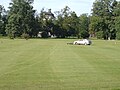
Grass-cutting of the golf field
Rectory
External links
Wikimedia Commons has media related to Kravaře.
Official website
v
t
e
Towns, market towns and villages of Opava District
Bělá
Bohuslavice
Bolatice
Branka u Opavy
Bratříkovice
Brumovice
Březová
Budišov nad Budišovkou
Budišovice
Čermná ve Slezsku
Darkovice
Děhylov
Dobroslavice
Dolní Benešov
Dolní Životice
Háj ve Slezsku
Hať
Hlavnice
Hlubočec
Hlučín
Hněvošice
Holasovice
Hrabyně
Hradec nad Moravicí
Chlebičov
Chuchelná
Chvalíkovice
Jakartovice
Jamnice
Jezdkovice
Kobeřice
Kozmice
Kravaře
Kružberk
Kyjovice
Lhotka u Litultovic
Litultovice
Ludgeřovice
Markvartovice
Melč
Mikolajice
Mladecko
Mokré Lazce
Moravice
Neplachovice
Nové Lublice
Nové Sedlice
Oldřišov
Opava
Otice
Píšť
Pustá Polom
Radkov
Raduň
Rohov
Skřipov
Slavkov
Služovice
Sosnová
Staré Těchanovice
Stěbořice
Strahovice
Sudice
Svatoňovice
Šilheřovice
Štáblovice
Štěpánkovice
Štítina
Těškovice
Třebom
Uhlířov
Velké Heraltice
Velké Hoštice
Větřkovice
Vítkov
Vršovice
Vřesina
Závada
This Moravian-Silesian Region location article is a stub. You can help Wikipedia by expanding it.
This article is about the letter of the alphabet. For other uses, see Y (disambiguation). See also: Wye (disambiguation) Y Y y (See below) Usage Writing system Latin script Type Alphabetic and Logographic Language of origin Latin language Phonetic usage [ y ] [ ɨ ] [ j ] [ iː ] [ ɪ ] [ ɘ ] [ ə ] [ ɯ ] [ ɛː ] [ j ] [ ɥ ] [ ɣ̟ ] / w aɪ / / aɪ / Unicode value U+0059, U+0079 Alphabetical position 25 History Development Υ υ 𐌖 Y y Time period 54 to present Descendants • U • V • W • Ỿ • ¥ • Ꮙ • Ꮍ • Ꭹ Sisters F Ѵ У Ў Ұ Ү ו و ܘ וּ וֹ ࠅ 𐎆 𐡅 ወ વ ૂ ુ उ Variations (See below) Other Other letters commonly used with y(x), ly, ny This article contains IPA phonetic symbols. Without proper rendering support, you may see question marks, boxes, or other symbols instead of Unicode characters. For an introductory guide on IPA symbols, see Help:IPA. ISO basic Latin alphabet Aa Bb Cc D...
Mount Tamalpais Mount Tamalpais, viewed from the south Highest point Elevation 2,571 ft (784 m) NAVD 88 [1] Prominence 2,456 ft (749 m) [1] Listing California county high points 55th Coordinates 37°55′45″N 122°34′40″W / 37.929088°N 122.577829°W / 37.929088; -122.577829 Coordinates: 37°55′45″N 122°34′40″W / 37.929088°N 122.577829°W / 37.929088; -122.577829 [1] Geography Mount Tamalpais Marin County, California, U.S. Show map of California Mount Tamalpais Mount Tamalpais (the US) Show map of the US Parent range California Coast Ranges Topo map USGS San Rafael Geology Mountain type Sedimentary Climbing First ascent 1830s by Jacob P. Leese (first recorded ascent) [2] Easiest route Railroad Grade fire trail Mount Tamalpais ( / t æ m əl ˈ p aɪ . ɪ s / ; TAM -əl- PY -iss ; Coast Miwok: /t̪ɑmɑlˈpɑis̺/ , known locally as Mount Tam ) is a peak in Marin County, California, United State...
FMW Women's Championship Details Promotion Frontier Martial-Arts Wrestling [1] Date established November 5, 1990 [1] Date retired September 28, 1997 Other name(s) WWA World Women's Championship FMW Independent Women's Championship Statistics First champion(s) Combat Toyoda [1] Most reigns Megumi Kudo (6 reigns) [1] Longest reign Megumi Kudo (426 days) [1] Shortest reign Shark Tsuchiya (<1 day) [1] The FMW Women's Championship (or the FMW Independent Women's & WWA Women's Championship ) was two Japanese women's professional wrestling championships (WWA World Women's Championship and FMW Independent World Women's Championship) contested in the promotion Frontier Martial-Arts Wrestling (FMW). During the heyday of FMW, the female wrestlers wrestled in the same types of bloody death matches as the FMW men, and were feared by other Japanese female wrestlers for their toughness and intensity. ...