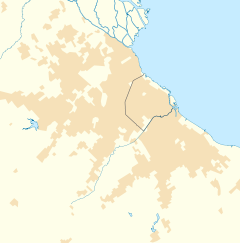
Boulogne Sur Mer is a town in Buenos Aires Province, Argentina. It is in San Isidro Partido and forms part of the Greater Buenos Aires urban conurbation, 26 km (16,25 mi) north of Buenos Aires. It has a population of 89,046 (2001 INDEC census). The town is named after the city of Boulogne-sur-Mer in northern France, where the Argentine general José de San Martín died in 1850.
Contents
1Transport
2Education
3References
4External links
Transport
By rail, the town in served by the narrow gauge Belgrano Norte Line, which has both regular and differential services. National Route 9 also passes through the town, giving direct access to the city of Buenos Aires and to provinces to the west.
Education
Goethe-Schule Buenos Aires, a German school, is in Boulogne.[1]
References
^Spanish homepage/German homepage. Goethe-Schule Buenos Aires. Retrieved on March 14, 2016. "Reclus 2250 (B1609DQL) Boulogne, Buenos Aires, Argentina."
External links
(in Spanish) Boulogne History
v
t
e
Greater Buenos Aires
First-level administrative divisions
Buenos Aires Autonomous City Buenos Aires Province
Buenos Aires Province partidos
Almirante Brown
Avellaneda
Berazategui
Esteban Echevarría
Ezeiza
Florencio Varela
Hurlingham
Ituzaingó
José C. Paz
Lanús
Lomas de Zamora
La Matanza
Malvinas Argentinas
Merlo
Moreno
Morón
Quilmes
San Fernando
San Isidro
San Martín
San Miguel
Tigre
3 de Febrero
Vicente López
List of cities
Autonomous City of Buenos Aires
Adrogué
Avellaneda
Banfield
Béccar
Bella Vista
Berazategui
Bernal
Boulogne Sur Mer
Burzaco
Caseros
Castelar
Ciudadela
Ciudad Evita
Ciudad Jardín
Ciudad Madero
Claypole
Dock Sud
Don Torcuato
El Palomar
Ezeiza
Florencio Varela
Florida Este
Florida Oeste
Haedo
General Pacheco
Gerli
Glew
González Catán
Gregorio de Laferrère
Grand Bourg
Guernica
Hurlingham
Isidro Casanova
Ituzaingó
José C. Paz
José Mármol
Lanús
La Tablada
Llavallol
Libertad
Lomas del Mirador
Lomas de Zamora
Longchamps
Los Polvorines
Mariano Acosta
Martínez
Merlo
Monte Chingolo
Monte Grande
Moreno
Morón
Munro
Muñiz
Olivos
Pablo Nogués
Parque San Martín
Paso del Rey
Pontevedra
Quilmes
Rafael Calzada
Rafael Castillo
Ramos Mejía
Remedios de Escalada
San Antonio de Padua
San Fernando
San Francisco Solano
San Isidro
San José
San Justo
San Martín
San Miguel
Sarandí
Temperley
Tigre
Tortuguitas
Tristán Suárez
Valentín Alsina
Vicente López
Victoria
Villa Adelina
Villa Ballester
Villa Bosch
Villa Centenario
Villa Domínico
Villa Fiorito
Villa La Florida
Villa Maipú
Villa Martelli
Villa de Mayo
Villa Tesei
Villa Udaondo
Virreyes
Wilde
William C. Morris
Lesser settlements (towns and others)
Acassuso
Aldo Bonzi
Billinghurst
Campo de Mayo
Carapachay
Churruca
Dock Sud
Don Bosco
El Libertador
José Ingenieros
La Lucila
Loma Hermosa
Lomas del Palomar
Martín Coronado
Once de Septiembre
Pablo Podestá
Ranelagh
Remedios de Escalada, Tres de Febrero
Sáenz Peña
Santos Lugares
Tapiales
Villa Raffo
Villa Sarmiento
This article about a place in Buenos Aires Province, Argentina is a stub. You can help Wikipedia by expanding it.
This article is about the letter of the alphabet. For other uses, see Y (disambiguation). See also: Wye (disambiguation) Y Y y (See below) Usage Writing system Latin script Type Alphabetic and Logographic Language of origin Latin language Phonetic usage [ y ] [ ɨ ] [ j ] [ iː ] [ ɪ ] [ ɘ ] [ ə ] [ ɯ ] [ ɛː ] [ j ] [ ɥ ] [ ɣ̟ ] / w aɪ / / aɪ / Unicode value U+0059, U+0079 Alphabetical position 25 History Development Υ υ 𐌖 Y y Time period 54 to present Descendants • U • V • W • Ỿ • ¥ • Ꮙ • Ꮍ • Ꭹ Sisters F Ѵ У Ў Ұ Ү ו و ܘ וּ וֹ ࠅ 𐎆 𐡅 ወ વ ૂ ુ उ Variations (See below) Other Other letters commonly used with y(x), ly, ny This article contains IPA phonetic symbols. Without proper rendering support, you may see question marks, boxes, or other symbols instead of Unicode characters. For an introductory guide on IPA symbols, see Help:IPA. ISO basic Latin alphabet Aa Bb Cc D...
Mount Tamalpais Mount Tamalpais, viewed from the south Highest point Elevation 2,571 ft (784 m) NAVD 88 [1] Prominence 2,456 ft (749 m) [1] Listing California county high points 55th Coordinates 37°55′45″N 122°34′40″W / 37.929088°N 122.577829°W / 37.929088; -122.577829 Coordinates: 37°55′45″N 122°34′40″W / 37.929088°N 122.577829°W / 37.929088; -122.577829 [1] Geography Mount Tamalpais Marin County, California, U.S. Show map of California Mount Tamalpais Mount Tamalpais (the US) Show map of the US Parent range California Coast Ranges Topo map USGS San Rafael Geology Mountain type Sedimentary Climbing First ascent 1830s by Jacob P. Leese (first recorded ascent) [2] Easiest route Railroad Grade fire trail Mount Tamalpais ( / t æ m əl ˈ p aɪ . ɪ s / ; TAM -əl- PY -iss ; Coast Miwok: /t̪ɑmɑlˈpɑis̺/ , known locally as Mount Tam ) is a peak in Marin County, California, United State...
FMW Women's Championship Details Promotion Frontier Martial-Arts Wrestling [1] Date established November 5, 1990 [1] Date retired September 28, 1997 Other name(s) WWA World Women's Championship FMW Independent Women's Championship Statistics First champion(s) Combat Toyoda [1] Most reigns Megumi Kudo (6 reigns) [1] Longest reign Megumi Kudo (426 days) [1] Shortest reign Shark Tsuchiya (<1 day) [1] The FMW Women's Championship (or the FMW Independent Women's & WWA Women's Championship ) was two Japanese women's professional wrestling championships (WWA World Women's Championship and FMW Independent World Women's Championship) contested in the promotion Frontier Martial-Arts Wrestling (FMW). During the heyday of FMW, the female wrestlers wrestled in the same types of bloody death matches as the FMW men, and were feared by other Japanese female wrestlers for their toughness and intensity. ...