Eaton County, Michigan
Eaton County, Michigan | ||
|---|---|---|
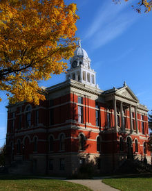 Eaton County Courthouse | ||
| ||
 Location in the U.S. state of Michigan | ||
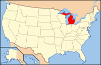 Michigan's location in the U.S. | ||
| Founded | 1837[1] | |
| Named for | John Eaton | |
| Seat | Charlotte | |
| Largest city | Charlotte | |
| Area | ||
| • Total | 579 sq mi (1,500 km2) | |
| • Land | 575 sq mi (1,489 km2) | |
| • Water | 4.3 sq mi (11 km2), 0.7% | |
| Population | ||
| • (2010) | 107,759 | |
| • Density | 187/sq mi (72/km2) | |
| Congressional district | 7th | |
| Time zone | Eastern | |

Eaton County is a county in the U.S. state of Michigan. As of the 2010 United States Census, the population was 107,759.[2] The county seat is Charlotte.[3] The county was organized in 1837; it was named for John Eaton, who was Secretary of War under US President Andrew Jackson, making it one of Michigan's Cabinet counties.[1]
Eaton County is included in the Lansing-East Lansing, Metropolitan Statistical area in Central Michigan.
Contents
1 History
2 Geography
2.1 Rivers
2.2 Adjacent counties
3 Transportation
3.1 Major highways
3.2 Airports
4 Demographics
5 Government
5.1 Elected officials
5.2 County Board of Commissioners
6 Education
7 Communities
7.1 Cities
7.2 Villages
7.3 Census-designated place
7.4 Other unincorporated communities
7.5 Townships
8 See also
9 References
10 External links
History
Eaton County was formed in 1837 from open territory. It was named after John H. Eaton, an American Secretary of War.[4] The county is one of the so-called Cabinet counties because it was named after a member of the cabinet of US President Andrew Jackson.[5]
Eaton County was created by the Michigan Territorial Legislature on October 29, 1829: "That as much of the country as is included within the following limits, viz., north of the base line and south of the line between townships four and five north of the base line, and east of the line between ranges six and seven west of the meridian, and west of the line between ranges two and three west of the meridian, be and the same is set off into a separate county, and the name thereof shall be Eaton." The county was named in honor of Gen. John H. Eaton, secretary of war in the cabinet of President Andrew Jackson. The following week (November 4), the legislature added this directive: "That the county of Eaton shall be attached to and compose a part of the county of St. Joseph." On November 5, they also added an act to direct that the counties of Eaton, Branch and Calhoun, and all the country north attached to Eaton be set off into a township by the name of Eaton, and it was ordered that the first town meeting should be held at the house of Jabez Bronson, who lived on the site of the present village of Bronson in Branch county. This was no hardship, for there was not at that time a single white settler within the bounds of Eaton county.
The following summer (July 30, 1830), the Territorial Legislature changed Eaton's assignment, attaching it to Kalamazoo for administrative, revenue, and judicial purposes. Then on March 17, 1835 it directed: "That the county of Eaton shall be a township of Belleville,' and the first township meeting shall be held at such place as the sheriff of Calhoun county shall appoint in said county of Eaton, and shall be attached to the county of Eaton for all judicial purposes."
By 1837 the Territory had been admitted to the Union as a State. On December 29 of that year, the new state legislature created Eaton County as an independent entity: "That the county of Eaton be and the same is hereby organized, and the inhabitants thereof entitled to all the rights and privileges to which by law the inhabitants of other counties of this state are entitled."
While the name "Belleville" was given to the first organized township, including the whole county, it does not appear to have been used in any official documents. The second place where the name of the township is mentioned in a legislative enactment is on March 17 in the session laws of 1837, where it appears under the name of "Bellevue." Official business has always been transacted under the latter name, and yet there is no known law showing that the name has ever been legally changed from "Belleville."
The first division of the town of Bellevue occurred on March 11, 1837, when Eaton and Vermontville were organized. The four northwestern townships, now Vermontville, Chester, Roxand and Sunfield, were set off as a township and named Vermontville; while the four southeastern townships, now Eaton, Eaton Rapids, Hamlin, and Brookfield were organized as the township of Eaton.
This left the four northeastern towns, Benton, Oneida, Delta, and Windsor, and the four remaining towns, Bellevue, Kalamo, Carmel, and Walton, cornering at the geographical center of the county in a single organized township known as Bellevue. But on March 6, 1838, the northeast quarter of the county was detached from Bellevue and was formed as the town of Oneida.
In 1832, a surveyor, George W. Barnes, bought a homestead in central Eaton County; that area is now contained in Charlotte. On March 21, 1833 he applied to Territorial Governor George B. Porter for a commission to be appointed to locate the county seat: "That in the month of may last he put up in three public places in the county of Kalamazoo notices that application would be made to the governor of the territory of Michigan to appoint commissioners to locate a seat of justice for Eaton County, agreeably to the law in such cases made and provided." Accordingly, three locals (Charles C. Hascall, Stillman Blanchard, John W. Strong) were named on April 29. On June 5 they reported to the Governor that they met "at Prairie Ronde [Round] in the county of Kalamazoo on the 27th day of May, 1833, and on June 4, located the county seat on land which is owned by George W. Barnes. The point selected for the seat of justice in this county is on a beautiful prairie, about one mile square, near two and a half miles south of the center of the county, and about one mile north of the Battle creek, the nearest point to the center of the county where water can be obtained for hydraulic purposes."
Geography
According to the US Census Bureau, the county has a total area of 579 square miles (1,500 km2), of which 575 square miles (1,490 km2) is land and 4.3 square miles (11 km2) (0.7%) is water.[6]
Rivers
- Battle Creek River
- Grand River
- Thornapple River
Adjacent counties
Clinton County – northeast
Ingham County – east
Jackson County – southeast
Calhoun County - south
Barry County – west
Ionia County – northwest
Transportation
Major highways
 I-69
I-69
 BL I-69
BL I-69
 I-96
I-96
 BL I-96
 I-496
I-496
 M-43
M-43
 M-50
M-50
 M-66
M-66
 M-78
M-78
 M-79
M-79
 M-99
M-99
 M-100
M-100
 M-188
M-188
Airports
Fitch H. Beach Airport - general aviation airport in Charlotte.
Capital Region International Airport in Clinton County, Michigan, northeast of Eaton County – airline service.- Rapids Airway Airport (light aviation, grass field, private use only) - two miles (3.2 km) NE of Eaton Rapids.[7]
Demographics
| Historical population | |||
|---|---|---|---|
| Census | Pop. | %± | |
| 1840 | 2,379 | — | |
| 1850 | 7,058 | 196.7% | |
| 1860 | 16,476 | 133.4% | |
| 1870 | 25,171 | 52.8% | |
| 1880 | 31,225 | 24.1% | |
| 1890 | 32,094 | 2.8% | |
| 1900 | 31,668 | −1.3% | |
| 1910 | 30,499 | −3.7% | |
| 1920 | 29,377 | −3.7% | |
| 1930 | 31,728 | 8.0% | |
| 1940 | 34,124 | 7.6% | |
| 1950 | 40,023 | 17.3% | |
| 1960 | 49,684 | 24.1% | |
| 1970 | 68,892 | 38.7% | |
| 1980 | 88,337 | 28.2% | |
| 1990 | 92,879 | 5.1% | |
| 2000 | 103,655 | 11.6% | |
| 2010 | 107,759 | 4.0% | |
| Est. 2017 | 109,027 | [8] | 1.2% |
| US Decennial Census[9] 1790-1960[10] 1900-1990[11] 1990-2000[12] 2010-2013[2] | |||
As of the 2010 United States Census, there were 107,759 people residing in the county. 87.8% were White, 6.3% Black or African American, 1.7% Asian, 0.4% Native American, 1.2% of some other race and 2.6% of two or more races. 4.7% were Hispanic or Latino (of any race). 24.2% were of English ancestry, 22.9% were of German ancestry and 9.3% were of Irish ancestry.[13]
As of the 2000 United States Census,[14] there were 103,655 people, 40,167 households, and 28,237 families in the county. The population density was 180 people per square mile (69/km²). There were 42,118 housing units at an average density of 73 per square mile (28/km²). The racial makeup of the county was 90.25% White, 5.29% Black or African American, 0.44% Native American, 1.13% Asian, 0.03% Pacific Islander, 1.17% from other races, and 1.70% from two or more races. 3.21% of the population were Hispanic or Latino of any race. 95.6% spoke only English, while 2.0% spoke Spanish.
There were 40,167 households out of which 33.80% had children under the age of 18 living with them, 56.30% were married couples living together, 10.30% had a female householder with no husband present, and 29.70% were non-families. 24.50% of all households were made up of individuals and 8.40% had someone living alone who was 65 years of age or older. The average household size was 2.54 and the average family size was 3.03.
The county population contained 26.10% under the age of 18, 9.10% from 18 to 24, 28.80% from 25 to 44, 24.60% from 45 to 64, and 11.30% who were 65 years of age or older. The median age was 36 years. For every 100 females, there were 94.60 males. For every 100 females age 18 and over, there were 91.50 males.
The median income for a household in the county was $49,588, and the median income for a family was $57,898. Males had a median income of $41,978 versus $29,638 for females. The per capita income for the county was $22,411. About 4.10% of families and 5.80% of the population were below the poverty line, including 6.80% of those under age 18 and 5.90% of those age 65 or over.
Government
Eaton County has been reliably Republican from the beginning. Since 1884, the Republican Party nominee has carried the county vote in 80% of the elections (27 of 34 elections).
| Year | Republican | Democratic | Third Parties |
|---|---|---|---|
2016 | 48.8% 27,609 | 44.1% 24,938 | 7.1% 4,028 |
2012 | 47.8% 26,197 | 51.0% 27,913 | 1.2% 678 |
2008 | 45.0% 25,900 | 53.4% 30,742 | 1.7% 974 |
2004 | 53.4% 29,781 | 45.6% 25,411 | 1.0% 563 |
2000 | 50.3% 24,803 | 47.1% 23,211 | 2.6% 1,258 |
1996 | 45.0% 20,092 | 44.3% 19,781 | 10.7% 4,793 |
1992 | 39.0% 18,669 | 35.0% 16,752 | 26.0% 12,462 |
1988 | 60.8% 24,193 | 38.5% 15,322 | 0.7% 291 |
1984 | 72.6% 27,720 | 26.9% 10,290 | 0.5% 189 |
1980 | 57.4% 22,927 | 31.9% 12,742 | 10.8% 4,308 |
1976 | 63.7% 22,120 | 34.8% 12,083 | 1.6% 547 |
1972 | 68.5% 20,413 | 30.1% 8,986 | 1.4% 412 |
1968 | 57.1% 14,184 | 33.6% 8,347 | 9.2% 2,295 |
1964 | 41.4% 8,919 | 58.4% 12,590 | 0.2% 46 |
1960 | 67.0% 14,163 | 32.7% 6,912 | 0.4% 74 |
1956 | 69.3% 13,762 | 30.5% 6,053 | 0.2% 35 |
1952 | 72.2% 13,723 | 27.2% 5,170 | 0.7% 125 |
1948 | 64.8% 8,637 | 32.0% 4,264 | 3.2% 419 |
1944 | 65.9% 9,975 | 33.4% 5,049 | 0.8% 116 |
1940 | 63.3% 9,864 | 36.2% 5,645 | 0.6% 85 |
1936 | 47.4% 6,649 | 48.3% 6,780 | 4.3% 602 |
1932 | 44.3% 5,840 | 52.3% 6,887 | 3.4% 445 |
1928 | 78.4% 8,493 | 21.1% 2,285 | 0.5% 58 |
1924 | 73.7% 8,232 | 22.0% 2,462 | 4.3% 481 |
1920 | 71.0% 7,343 | 26.4% 2,727 | 2.7% 274 |
1916 | 50.8% 3,802 | 46.3% 3,461 | 2.9% 218 |
1912 | 32.0% 2,333 | 34.1% 2,482 | 33.9% 2,472 |
1908 | 55.9% 4,364 | 40.1% 3,131 | 4.0% 309 |
1904 | 69.4% 5,553 | 26.8% 2,141 | 3.9% 309 |
1900 | 53.8% 4,809 | 43.7% 3,908 | 2.5% 225 |
1896 | 47.0% 4,270 | 51.0% 4,631 | 2.1% 189 |
1892 | 48.2% 3,788 | 36.1% 2,837 | 15.6% 1,228 |
1888 | 52.1% 4,624 | 36.8% 3,266 | 11.1% 983 |
1884 | 49.4% 4,106 | 44.7% 3,717 | 5.9% 494 |
The county government operates the jail, maintains rural roads, operates the major local courts, records deeds, mortgages, and vital records, administers public health regulations, and participates with the state in the provision of social services. The county
board of commissioners controls the budget and has limited authority to make laws or ordinances. In Michigan, most local government functions — police and fire, building and zoning, tax assessment, street maintenance, etc. — are the responsibility of individual cities and townships.
Elected officials
Prosecuting Attorney: Doug Lloyd (R)
Sheriff: Tom Reich (D)
County Clerk/Register of Deeds: Diana Bosworth (R)
County Treasurer: Bob Robinson, APR (D)
Drain Commissioner: Richard Wagner (R)- Circuit Court Judge: Jan Cunningham
- Circuit Court Judge: Jeffery Sauter
- Probate Court Judge: Thomas K. Byerley
County Board of Commissioners
15 members, elected from districts (9 Republicans, 6 Democrats)
Education
School districts located in Eaton County:
- Bellevue Community Schools, Bellevue
Charlotte Public Schools, Charlotte
Eaton Intermediate School District, Charlotte- Eaton Rapids Public Schools, Eaton Rapids
Grand Ledge Public Schools, Grand Ledge. Village of Mulliken schools was annexed by Grand Ledge Public Schools
Maple Valley Schools, Vermontville
- Olivet Community Schools, Olivet
- Oneida Township S/D #3, Oneida Township
- Potterville Public Schools, Potterville
- Roxand Township School District #12, Roxand Township
- Waverly Community Schools, Delta Township
Some county residents attend out-of-county schools:
- Village of Dimondale (Holt Public Schools, Holt, Ingham County)
- Village of Sunfield (Lakewood Public Schools, Lake Odessa, Ionia County)
- A small portion of northeast Delta Township (Lansing Public Schools, Lansing, Ingham County)
- Ingham Intermediate School District (Waverly Community Schools, Village of Dimondale, portion of Delta Township)
- Ionia Intermediate School District (Village of Sunfield)
- Calhoun Intermediate School District ( Bellevue Community Schools, Olivet Community Schools)
Communities
Cities
Charlotte (county seat)- Eaton Rapids
- Grand Ledge
Lansing (partial)- Olivet
- Potterville
Villages
- Bellevue
- Dimondale
- Mulliken
- Sunfield
- Vermontville
Census-designated place
- Waverly
Other unincorporated communities
Ainger (called Thurman in 1887)- Bismark
- Brookfield
- Canada Settlement
Carlisle (called Hyde's Mills until 1843)- Charlesworth
- Chester
- Clinton Junction
- Delta Center
Delta Mills (originally called Grand River City)- Delwood
- East Walton
- Elmira
- Five Points Corner
- Gresham
- Hoytville
- Kalamo
- Kelly
- Kingsland
- Little Venice
Millett (originally called Millett's Station)- Moore's Station
- Needmore
- Oneida Center
- Packard
- Petrieville
- Shaytown
- Stalls Corner
Walton (called East Bellevue until 1840)- West Benton
- West Windsor
- Woodbury
Townships
- Bellevue Township
- Benton Township
- Brookfield Township
- Carmel Township
- Chester Township
- Delta Charter Township
- Eaton Rapids Township
- Eaton Township
- Hamlin Township
- Kalamo Township
- Oneida Charter Township
- Roxand Township
- Sunfield Township
- Vermontville Township
- Walton Township
- Windsor Charter Township
See also
- List of Michigan State Historic Sites in Eaton County, Michigan
- National Register of Historic Places listings in Eaton County, Michigan
References
^ ab "Bibliography on Eaton County". Clarke Historical Library, Central Michigan University. Retrieved January 19, 2013..mw-parser-output cite.citation{font-style:inherit}.mw-parser-output q{quotes:"""""""'""'"}.mw-parser-output code.cs1-code{color:inherit;background:inherit;border:inherit;padding:inherit}.mw-parser-output .cs1-lock-free a{background:url("//upload.wikimedia.org/wikipedia/commons/thumb/6/65/Lock-green.svg/9px-Lock-green.svg.png")no-repeat;background-position:right .1em center}.mw-parser-output .cs1-lock-limited a,.mw-parser-output .cs1-lock-registration a{background:url("//upload.wikimedia.org/wikipedia/commons/thumb/d/d6/Lock-gray-alt-2.svg/9px-Lock-gray-alt-2.svg.png")no-repeat;background-position:right .1em center}.mw-parser-output .cs1-lock-subscription a{background:url("//upload.wikimedia.org/wikipedia/commons/thumb/a/aa/Lock-red-alt-2.svg/9px-Lock-red-alt-2.svg.png")no-repeat;background-position:right .1em center}.mw-parser-output .cs1-subscription,.mw-parser-output .cs1-registration{color:#555}.mw-parser-output .cs1-subscription span,.mw-parser-output .cs1-registration span{border-bottom:1px dotted;cursor:help}.mw-parser-output .cs1-hidden-error{display:none;font-size:100%}.mw-parser-output .cs1-visible-error{font-size:100%}.mw-parser-output .cs1-subscription,.mw-parser-output .cs1-registration,.mw-parser-output .cs1-format{font-size:95%}.mw-parser-output .cs1-kern-left,.mw-parser-output .cs1-kern-wl-left{padding-left:0.2em}.mw-parser-output .cs1-kern-right,.mw-parser-output .cs1-kern-wl-right{padding-right:0.2em}
^ ab "State & County QuickFacts". US Census Bureau. Archived from the original on July 9, 2011. Retrieved August 27, 2013.
^ "Find a County". National Association of Counties. Archived from the original on July 12, 2012. Retrieved June 7, 2011.
^ Gannett, Henry (1905). The Origin of Certain Place Names in the United States. Govt. Print. Off. p. 113.
^ "Archived copy". Archived from the original on February 14, 2010. Retrieved January 13, 2011.CS1 maint: Archived copy as title (link)
^ "2010 Census Gazetteer Files". US Census Bureau. August 22, 2012. Archived from the original on November 13, 2013. Retrieved September 21, 2014.
^ Rapids Airway Airport (AirNav.com) - accessed 2 September 2018
^ "Population and Housing Unit Estimates". Retrieved March 23, 2018.
^ "US Decennial Census". US Census Bureau. Archived from the original on May 12, 2015. Retrieved September 21, 2014.
^ "Historical Census Browser". University of Virginia Library. Retrieved September 21, 2014.
^ "Population of Counties by Decennial Census: 1900 to 1990". US Census Bureau. Retrieved September 21, 2014.
^ "Census 2000 PHC-T-4. Ranking Tables for Counties: 1990 and 2000" (PDF). US Census Bureau. Retrieved September 21, 2014.
^ Data Access and Dissemination Systems (DADS). "American FactFinder".
^ "American FactFinder". US Census Bureau. Retrieved January 31, 2008.
^ Leip, David. "Dave Leip's Atlas of US Presidential Elections". uselectionatlas.org. Retrieved April 6, 2018.
External links
- Official Website of Eaton County
- History of Eaton County
"Bibliography on Eaton County". Clarke Historical Library, Central Michigan University.
Places adjacent to Eaton County, Michigan | ||||||||||
|---|---|---|---|---|---|---|---|---|---|---|
| ||||||||||
Municipalities and communities of Eaton County, Michigan, United States | ||
|---|---|---|
County seat: Charlotte | ||
| Cities |
|  |
| Villages |
| |
| Charter townships |
| |
| General law townships |
| |
| CDP |
| |
| Footnotes | ‡This populated place also has portions in an adjacent county or counties | |
Central/Mid-Michigan including the Tri-Cities and Thumb | |||||||
|---|---|---|---|---|---|---|---|
| Central cities |
| ||||||
| Counties |
| ||||||
| Geography |
| ||||||
| Transportation |
| ||||||
| Economy |
| ||||||
| |||||||
Lansing (capital) | ||
| Topics |
|  |
| Society |
| |
| Regions |
| |
| Largest municipalities |
| |
| Counties |
| |
Coordinates: 42°35′N 84°51′W / 42.59°N 84.85°W / 42.59; -84.85


