Missouri's 1st congressional district
| Missouri's 1st congressional district | |
|---|---|
 Missouri's 1st congressional district - since January 3, 2013. | |
| U.S. Representative | William Lacy Clay Jr. (D–St. Louis) |
| Distribution |
|
| Population (2010) | 739,775 |
| Median income | $45,789[1] |
| Ethnicity |
|
| Cook PVI | D+29[2] |
Missouri's first congressional district is in the eastern portion of the state. It includes all of St. Louis City and much of northern St. Louis County.
Its current representative is Democrat William Lacy Clay Jr., who was elected in 2001. Clay's father, Bill Clay, had previously represented the district for over thirty years.
Contents
1 List of members representing the district
2 Election results from presidential races
3 Historical district boundaries
4 See also
5 References
List of members representing the district
| Congress | Representative | Party | Years | Electoral history | |
|---|---|---|---|---|---|
| District created March 4, 1847 | |||||
30th 31st | 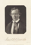 James B. Bowlin | Democratic | March 4, 1847 – March 3, 1851 | Redistricted from the at-large district. | |
32nd |  John F. Darby | Whig | March 4, 1851 – March 3, 1853 | [Data unknown/missing.] | |
33rd |  Thomas Hart Benton | Democratic | March 4, 1853 – March 3, 1855 | [Data unknown/missing.] | |
34th |  Luther M. Kennett | Opposition | March 4, 1855 – March 3, 1857 | [Data unknown/missing.] | |
35th | 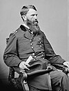 Francis P. Blair Jr. | Republican | March 4, 1857 – March 3, 1859 | [Data unknown/missing.] | |
36th | 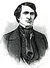 John R. Barret | Democratic | March 4, 1859 – June 8, 1860 | Lost contested election | |
Francis P. Blair Jr. | Republican | June 8, 1860 – June 25, 1860 | Won contested election, Resigned | ||
| Vacant | June 25, 1860 – October 3, 1860 | ||||
John R. Barret | Democratic | October 3, 1860 – March 3, 1861 | [Data unknown/missing.] | ||
37th 38th | Francis P. Blair Jr. | Republican | March 4, 1861 – June 10, 1864 | Lost contested election | |
38th | 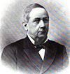 Samuel Knox | Unconditional Unionist | June 10, 1864 – March 3, 1865 | Won contested election | |
39th | 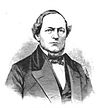 John Hogan | Democratic | March 4, 1865 – March 3, 1867 | [Data unknown/missing.] | |
40th |  William A. Pile | Republican | March 4, 1867 – March 3, 1869 | [Data unknown/missing.] | |
41st 42nd |  Erastus Wells | Democratic | March 4, 1869 – March 3, 1873 | Redistricted to the 2nd district | |
43rd | 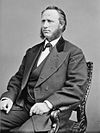 Edwin O. Stanard | Republican | March 4, 1873 – March 3, 1875 | [Data unknown/missing.] | |
44th | 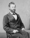 Edward C. Kehr | Democratic | March 4, 1875 – March 3, 1877 | [Data unknown/missing.] | |
45th | 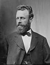 Anthony F. Ittner | Republican | March 4, 1877 – March 3, 1879 | [Data unknown/missing.] | |
46th 47th | 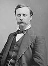 Martin L. Clardy | Democratic | March 3, 1879 – March 3, 1883 | Redistricted to the 10th district | |
48th 49th 50th 51st 52nd 53rd | 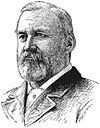 William H. Hatch | Democratic | March 4, 1883 – March 3, 1895 | Redistricted from the 12th district. | |
54th |  Charles N. Clark | Republican | March 4, 1895 – March 3, 1897 | [Data unknown/missing.] | |
55th | Vacant | March 4, 1897 – June 1, 1897 | |||
55th 56th 57th 58th 59th 60th 61st 62nd 63rd 64th | 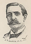 James T. Lloyd | Democratic | June 1, 1897 – March 3, 1917 | Elected after death of Rep-elect Richard P. Giles | |
65th 66th |  Milton A. Romjue | Democratic | March 4, 1917 – March 3, 1921 | [Data unknown/missing.] | |
67th | 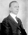 Frank C. Millspaugh | Republican | March 4, 1921 – December 5, 1922 | Resigned | |
| Vacant | December 5, 1922 – March 4, 1923 | ||||
68th 69th 70th 71st 72nd | Milton A. Romjue | Democratic | March 4, 1923 – March 3, 1933 | Redistricted to the At-large district | |
73rd | March 4, 1933 – January 3, 1935 | District inactive, all representatives elected At-large on a general ticket | |||
74th 75th 76th 77th | Milton A. Romjue | Democratic | January 3, 1935 – January 3, 1943 | Redistricted to the At-large district | |
78th 79th 80th |  Samuel W. Arnold | Republican | January 3, 1943 – January 3, 1949 | [Data unknown/missing.] | |
81st 82nd | 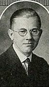 Clare Magee | Democratic | January 3, 1949 – January 3, 1953 | [Data unknown/missing.] | |
83rd 84th 85th 86th 87th 88th 89th 90th | 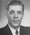 Frank M. Karsten | Democratic | January 3, 1953 – January 3, 1969 | Redistricted from the 13th district. | |
91st 92nd 93rd 94th 95th 96th 97th 98th 99th 100th 101st 102nd 103rd 104th 105th 106th | 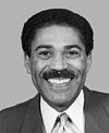 Bill Clay | Democratic | January 3, 1969 – January 3, 2001 | [Data unknown/missing.] | |
107th 108th 109th 110th 111th 112th 113th 114th 115th 116th | 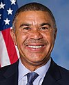 Lacy Clay | Democratic | January 3, 2001 – present | [Data unknown/missing.] | |
Election results from presidential races
| Year | Office | Results | Political parties that won the district |
|---|---|---|---|
| 2000 | President | Al Gore 72 - George W. Bush 26% | Democrat |
| 2004 | President | John Kerry 75 - George W. Bush 25% | Democrat |
| 2008 | President | Barack Obama 80 - John McCain 19% | Democrat |
| 2012 | President | Barack Obama 80 - Mitt Romney 19% | Democrat |
| 2016 | President | Hillary Clinton 77 - Donald Trump 19% | Democrat |
Historical district boundaries

2003 - 2013
See also
- Missouri's congressional districts
- List of United States congressional districts
References
^ https://www.census.gov/mycd/?st=29&cd=01
^ "Partisan Voting Index – Districts of the 115th Congress" (PDF). The Cook Political Report. April 7, 2017. Retrieved April 7, 2017..mw-parser-output cite.citation{font-style:inherit}.mw-parser-output .citation q{quotes:"""""""'""'"}.mw-parser-output .citation .cs1-lock-free a{background:url("//upload.wikimedia.org/wikipedia/commons/thumb/6/65/Lock-green.svg/9px-Lock-green.svg.png")no-repeat;background-position:right .1em center}.mw-parser-output .citation .cs1-lock-limited a,.mw-parser-output .citation .cs1-lock-registration a{background:url("//upload.wikimedia.org/wikipedia/commons/thumb/d/d6/Lock-gray-alt-2.svg/9px-Lock-gray-alt-2.svg.png")no-repeat;background-position:right .1em center}.mw-parser-output .citation .cs1-lock-subscription a{background:url("//upload.wikimedia.org/wikipedia/commons/thumb/a/aa/Lock-red-alt-2.svg/9px-Lock-red-alt-2.svg.png")no-repeat;background-position:right .1em center}.mw-parser-output .cs1-subscription,.mw-parser-output .cs1-registration{color:#555}.mw-parser-output .cs1-subscription span,.mw-parser-output .cs1-registration span{border-bottom:1px dotted;cursor:help}.mw-parser-output .cs1-ws-icon a{background:url("//upload.wikimedia.org/wikipedia/commons/thumb/4/4c/Wikisource-logo.svg/12px-Wikisource-logo.svg.png")no-repeat;background-position:right .1em center}.mw-parser-output code.cs1-code{color:inherit;background:inherit;border:inherit;padding:inherit}.mw-parser-output .cs1-hidden-error{display:none;font-size:100%}.mw-parser-output .cs1-visible-error{font-size:100%}.mw-parser-output .cs1-maint{display:none;color:#33aa33;margin-left:0.3em}.mw-parser-output .cs1-subscription,.mw-parser-output .cs1-registration,.mw-parser-output .cs1-format{font-size:95%}.mw-parser-output .cs1-kern-left,.mw-parser-output .cs1-kern-wl-left{padding-left:0.2em}.mw-parser-output .cs1-kern-right,.mw-parser-output .cs1-kern-wl-right{padding-right:0.2em}
Martis, Kenneth C. (1989). The Historical Atlas of Political Parties in the United States Congress. New York: Macmillan Publishing Company.
Martis, Kenneth C. (1982). The Historical Atlas of United States Congressional Districts. New York: Macmillan Publishing Company.
- Congressional Biographical Directory of the United States 1774–present
- https://web.archive.org/web/20131013222920/http://2010.census.gov/2010census/popmap/
- [1]
Coordinates: 38°43′42″N 90°17′46″W / 38.72833°N 90.29611°W / 38.72833; -90.29611


