South Ostrobothnia
South Ostrobothnia Etelä-Pohjanmaan maakunta landskapet Södra Österbotten | |||
|---|---|---|---|
Region | |||
| |||
 South Ostrobothnia on a map of Finland | |||
| Coordinates: 62°45′N 22°30′E / 62.750°N 22.500°E / 62.750; 22.500Coordinates: 62°45′N 22°30′E / 62.750°N 22.500°E / 62.750; 22.500 | |||
| Country | Finland | ||
| Historical province | Ostrobothnia, Satakunta | ||
| Area | |||
| • Total | 13,999.63 km2 (5,405.29 sq mi) | ||
| Population (2013) | |||
| • Total | 193,977 | ||
| • Density | 14/km2 (36/sq mi) | ||
| ISO 3166 code | FI-03 | ||
| NUTS | 194 | ||
| Regional bird | Eurasian curlew (Numenius arquata) | ||
| Regional fish | - | ||
| Regional flower | Fireweed (Epilobium angustifolium) | ||
| Website | etelapohjanmaa.fi | ||


South Ostrobothnia[1] (Finnish: Etelä-Pohjanmaa; Swedish: Södra Österbotten) is one of the 19 regions of Finland. It borders the regions of Ostrobothnia, Central Ostrobothnia, Central Finland, Pirkanmaa, and Satakunta.
Seinäjoki is the regional centre and by far the largest city in the area.
Contents
1 Historical provinces
2 Municipalities
3 Culture
4 Gallery
5 References
6 External links
Historical provinces
Municipalities
The region of South Ostrobothnia is made up of 17 municipalities, of which eight have city status (marked in bold).
Järviseutu sub-region:
Kuusiokunnat sub-region:
| Seinäjoki sub-region:
Suupohja sub-region:
|
Culture
Some people have made this region better known to the world. For example, The Dudesons and the traditional Finnish sweater Jussishirt are something people would remember when asked about South Ostrobothnia.
One of the biggest rock festivals in Finland, Provinssirock and world's oldest tango festival Tangomarkkinat are both held in Seinäjoki.
Gallery

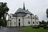
Seinäjoki Town Hall and Lakeuden Risti Church tower by Alvar Aalto

Yli-Laurosela, a museum for Ostrobothnian peasant culture in Ilmajoki

Typical Ostrobothnian plains in Töysä
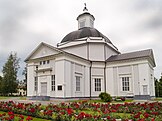
Lapua Cathedral, the only wooden cathedral in Finland
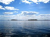
Lake Lappajärvi, Lappajärvi

Kuortane Church

Marshland in Kauhaneva-Pohjakangas National Park, Kauhajoki
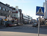
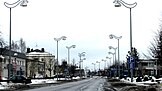
A street view in Seinäjoki
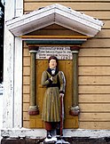
A poor man statue at Lappajärvi Church
Alavus Church
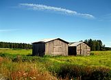
Typical barns of two different ages in Lappajärvi

Lehtimäki Church
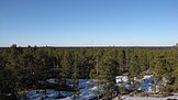
The Ostrobothian horizont in Jalasjärvi

Bears in Ähtäri Zoo
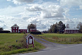
A village landscape in Kuortane

The limestome quarry in Vimpeli
Kauhajoki town centre

A building of Veljekset Keskinen, a shopping mall in rural area in Töysä
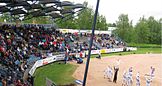
Pesäpallo (Finnish baseball) in Vimpeli
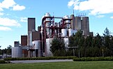
Koskenkorva distillery in Koskenkorva, Ilmajoki


References
^ https://www.stat.fi/meta/luokitukset/maakunta/001-2018/index_en.html
External links
| Wikimedia Commons has media related to Southern Ostrobothnia. |
- Official South Ostrobothnia website
Regions of Finland | ||
|---|---|---|
| Regions |
| |
| Former regions |
| |
This Western Finland location article is a stub. You can help Wikipedia by expanding it. |


