科克 (爱尔兰)
| 本条目需要編修,以確保文法、用詞、语气、格式、標點等使用恰当。(2016年11月18日) |
| 本条目需要擴充。(2016年11月18日) |
body.skin-minerva .mw-parser-output table.infobox caption{text-align:center}
科克 Cork Corcaigh | |||
|---|---|---|---|
 從上到下, 左到右: 科克市議會, 英國市場, 科克大學庭院, 利河, 聖安妮教堂 | |||
| |||
綽號:反叛之城、里賽、真正的首都 | |||
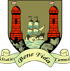
格言:Statio Bene Fida Carinis (拉丁語) A safe harbour for ships"安全停泊之港" | |||
 科克 Cork | |||
坐标:51°54′00″N 8°28′23″W / 51.9°N 8.4731°W / 51.9; -8.4731 | |||
| 國家 | 愛爾蘭 | ||
| 省 | 芒斯特 | ||
| 郡 | 科克郡 | ||
| 建城 | 西元6世紀 | ||
| 城市地位 | 1185年 | ||
| 政府 | |||
| • 类型 | 科克市議會 | ||
| • 市長 | 米克·奧康 (工黨) | ||
| • 選區 | 6 | ||
| • 歐洲議會 | 南區 | ||
| 面积 | |||
| • 城市 | 37.3 平方公里(14.4 平方英里) | ||
| 人口(2006年) | |||
| • 城市 | 119,230 | ||
| • 密度 | 3,194.18/平方公里(8,272.9/平方英里) | ||
| • 市区 | 190,384 | ||
| • 都會區 | 274,000 | ||
| • Demonym | Corkonian, Leesider | ||
| 时区 | WET (UTC+0) | ||
| • 夏时制 | IST(UTC+1) | ||
| 電話區號 | 021 | ||
| 網站 | www.corkcity.ie | ||
科克(愛爾蘭語:Corcaigh,發音[korkɪɟ]意思是「沼澤」,英语:Cork)是愛爾蘭共和國的第二大城市和愛爾蘭島的第三大城市(位於都柏林和貝爾法斯特之後)。它是科克郡的主要城市和行政中心,也是芒斯特省最大的城市。科克有119,230人口,而郊區郡中有190,384人口,大科克都會區人口約274,000人,大科克都會區面積約38萬。[1]
科克郡獲得了“反叛之郡”的綽號,而科克通常稱為“真正的愛爾蘭首都”的城市,和自己的“反叛派”。城市建立在利河的兩邊。利河穿城而过,從科克港(世界上最大的天然港口之一,也是愛爾蘭的大型港口之一)注入凯尔特海。
目录
1 氣候
2 友好城市
3 相關條目
4 參考資料
5 外部链接
氣候
| Cork Airport (1962-1991)气候平均数据 | |||||||||||||
|---|---|---|---|---|---|---|---|---|---|---|---|---|---|
| 月份 | 1月 | 2月 | 3月 | 4月 | 5月 | 6月 | 7月 | 8月 | 9月 | 10月 | 11月 | 12月 | 全年 |
| 平均高温℃(℉) | 7.6 (45.7) | 7.5 (45.5) | 9.3 (48.7) | 11.3 (52.3) | 13.8 (56.8) | 16.6 (61.9) | 18.5 (65.3) | 18.2 (64.8) | 16.0 (60.8) | 13.1 (55.6) | 9.9 (49.8) | 8.5 (47.3) | 12.5 (54.5) |
| 平均低温℃(℉) | 2.6 (36.7) | 2.5 (36.5) | 3.1 (37.6) | 4.2 (39.6) | 6.5 (43.7) | 9.2 (48.6) | 11.1 (52) | 10.9 (51.6) | 9.4 (48.9) | 7.5 (45.5) | 4.5 (40.1) | 3.7 (38.7) | 6.3 (43.3) |
| 平均降水量㎜(英寸) | 138.3 (5.445) | 115.6 (4.551) | 98.7 (3.886) | 67.7 (2.665) | 83.4 (3.283) | 68.8 (2.709) | 66.4 (2.614) | 88.7 (3.492) | 96.4 (3.795) | 125.4 (4.937) | 111.1 (4.374) | 133.8 (5.268) | 1,194.4 (47.024) |
| 来源:Met Éireann | |||||||||||||
友好城市
科克也是歐洲古老城鎮網絡的其中一員[2]以下的地方為友好城市[3]:
| 城市 | 國家 | 自 |
|---|---|---|
科芬特里 | 1969年 | |
雷恩 | 1982年 | |
舊金山 | 1984年 | |
科隆 | 1988年 | |
斯溫西 | 1994年 | |
上海 | 1994年 |
相關條目
- 科克国际机场
參考資料
^ Census of Ireland, 2011. Central Statistics Office, "Actual and Percentage Change in Population by Aggregate Town or Rural Area, Sex, Province County or City, Statistical Indicator and Census Year"
^ MAETN. diktyo. classic-web.archive.org. 1999 [last update] [19 May 2011]. (原始内容存档于2005年10月22日). 请检查|date=中的日期值 (帮助)
^ Cork City Council list of twined cities
外部链接
- 科克市议会
- 科克城足球俱乐部
- 科克大学
- 科克科技学院
- 科克电影中心
- 科克电影节
- 科克爵士音乐节
- Photos Cork

利河上的帕特里克桥

维基共享资源中相关的多媒体资源:科克 (爱尔兰) |
| ||||||
| ||||||||||||||||||||||||||||||||||||||||
|

