Tarimoro, Guanajuato
Tarimoro | |
|---|---|
| Country | |
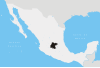
| State | Guanajuato |
| Municipality | Tarimoro |
| Time zone | UTC-6 (Central (US Central)) |
| • Summer (DST) | UTC-5 (Central) |
Tarimoro is the municipal seat of the municipality of Tarimoro in the Mexican state of Guanajuato. The official name of this town is Tarimoro.
Contents
1 History
2 Geography and Climate
2.1 Climate
3 Agriculture
4 References
5 External links
History
The original settlement was a community of Otomi people who were later conquered by the tarascós. The latter named this place Tarimoro, which means "Place of willows." The town was founded back in the epic of colonization by Don Lucas of San Juan on January 3, 1563. In 1910, its name was changed to Ciudad Obregon Gonzalez, by decree of the state Congress, in honor of the then state governor, Joaquin Gonzalez Obregon. However, the official name was later changed back to Tarimoro.
Geography and Climate
Tarimoro is located in Guanajuato. This place is bordered to the North by Celaya, to the Northwest by Apaseo del Alto, to the west by Jérecuaro, to the South by Acámbaro and to the West by Salvatierra.
Tarimoro represents 1.8% of the area of the State of Guanajuato; this is equal to 366.88 km2 (141.65 sq mi). It has 64 residents per square kilometer (166/square mile).
The most important localities of this town are: La Noria de Gallegos, San Juan Bautista Cacalote, Panales de Jamaica, La Moncada, Galera de Panales and Acebuche.
Climate
The weather is humid with rain in the summer. The average annual temperature is 19.9 °C (68 °F). The average annual rainfall reaches 700 millimeters. The maximum and minimum temperatures are 36 °C (97 °F) and 2 °C (36 °F), respectively.[1]
Agriculture
The main crops are corn, sorghum, and sweet potato. Of the 84 hectares (208 acres) sown during the agricultural year of 2000, 75.9% were temporary and 24.1% irrigation.
Livestock
The stock was recorded in the following figures:
- Concept Heads
- Bovine 5,592
- Pork 9,908
- Sheep 1,249
- Caprino 690
References
^ "protección civil". Retrieved 7 December 2008..mw-parser-output cite.citation{font-style:inherit}.mw-parser-output q{quotes:"""""""'""'"}.mw-parser-output code.cs1-code{color:inherit;background:inherit;border:inherit;padding:inherit}.mw-parser-output .cs1-lock-free a{background:url("//upload.wikimedia.org/wikipedia/commons/thumb/6/65/Lock-green.svg/9px-Lock-green.svg.png")no-repeat;background-position:right .1em center}.mw-parser-output .cs1-lock-limited a,.mw-parser-output .cs1-lock-registration a{background:url("//upload.wikimedia.org/wikipedia/commons/thumb/d/d6/Lock-gray-alt-2.svg/9px-Lock-gray-alt-2.svg.png")no-repeat;background-position:right .1em center}.mw-parser-output .cs1-lock-subscription a{background:url("//upload.wikimedia.org/wikipedia/commons/thumb/a/aa/Lock-red-alt-2.svg/9px-Lock-red-alt-2.svg.png")no-repeat;background-position:right .1em center}.mw-parser-output .cs1-subscription,.mw-parser-output .cs1-registration{color:#555}.mw-parser-output .cs1-subscription span,.mw-parser-output .cs1-registration span{border-bottom:1px dotted;cursor:help}.mw-parser-output .cs1-hidden-error{display:none;font-size:100%}.mw-parser-output .cs1-visible-error{font-size:100%}.mw-parser-output .cs1-subscription,.mw-parser-output .cs1-registration,.mw-parser-output .cs1-format{font-size:95%}.mw-parser-output .cs1-kern-left,.mw-parser-output .cs1-kern-wl-left{padding-left:0.2em}.mw-parser-output .cs1-kern-right,.mw-parser-output .cs1-kern-wl-right{padding-right:0.2em}
External links
- Official site of Tarimoro Municipality
Coordinates: 20°17′19″N 100°45′29″W / 20.28861°N 100.75806°W / 20.28861; -100.75806
Guanajuato (capital) | ||
| Municipalities |
|  |


