La Unión Province, Peru
La Unión | |
|---|---|
Province | |
 Solimana volcano, La Unión Province | |
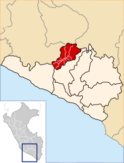 Location of La Unión in the Arequipa Region | |
| Country | Peru |
| Region | Arequipa |
| Capital | Cotahuasi |
| Area | |
| • Total | 4,746.4 km2 (1,832.6 sq mi) |
| Elevation | 2,388 m (7,835 ft) |
| Population | |
| • Total | 15,662 |
| • Density | 3.3/km2 (8.5/sq mi) |
| UBIGEO | 0408 |
| Website | www.municotahuasi.gob.pe |
La Unión is a province of the Arequipa Region in Peru. Its seat is Cotahuasi.
Contents
1 Geography
2 Political division
3 Ethnic groups
4 See also
5 Sources
6 External links
Geography
The Huanzo mountain range traverses the province. One of the highest peaks of the province is Solimana at 6,093 metres (19,990 ft). Other mountains are listed below:[1]
- Allqa Q'awa
- Allqa Walusa
Anka Phawa (Cond.-La Unión)
Anka Phawa (Puyca)- Anqasi
- Aqu Suntu
Aqu Suntu (Chullumpi)- Challwa Q'asa
- Chawpi Chawpi
- Chullumpi
- Chunta
- Chunta Pata
- Chhijmuni
- Ch'uwañuma
- Hatun Pata
- Hatun Sisiwa
- Inti Utka
- Janq'u Q'awa
- Kimsa Chata
- Khirki Urqu
- Khuchi Pata
- Lujmani
- Lunq'u
- Llamuqa
- Llimphiq
- Kuntur K'uchu
- Kuntur Sayana
Kunturi (Cond.-La Unión)
Kunturi (Ikmaqucha)
Kunturi (La Unión)- Kunturillu
- Minasniyuq
- Paxsi
- Pichaqani
- Pilluni
- Pirqasqa
- Pisti Q'asa
- Puka Ranra
- Puka Suntu
- Puka Urqu
- P'umpu Q'asa
- Qarwa K'uchu
- Qarwa Urqu
- Qillqata
- Kimsa Qaqa
- Qullpa
- Qullpa K'uchu
- Q'illu Urqu
- Rumi Urqu
- Saraqutu
- Sullu Marka
- Sunqu Urqu
- Suphu Marka
- Taruja Marka
- Taypi Q'awa
- Tintaya
- Thujsa
- T'ula Qaqa
- Uma Q'asa
- Waych'awi
- Wachu Willka
- Waraqu
- Wayrawiri
- Wayta Urqu
- Waytani
- Wila Quta
- Wiñaw
- Yana Yana
- Yuraq Apachita
- Yuraq Punta
- Yuraq Rumi
- Yuraq Urqu
Political division
The province is divided into eleven districts which are
- Alca
- Charcana
Cotahuasi (Province Seat)- Huaynacotas
- Pampamarca
- Puyca
- Quechualla
- Sayla
- Tauria
- Tomepampa
- Toro
Ethnic groups
The people in the province are mainly indigenous citizens of Quechua descent. Quechua is the language which the majority of the population (59.18%) learnt to speak in childhood, 40.06% of the residents started speaking using the Spanish language (2007 Peru Census).[2]
See also
- Cotahuasi Subbasin Landscape Reserve
- Ikmaqucha
- Mawk'allaqta
- Wansuqucha
Sources
^ escale.minedu.gob.pe - UGEL map of the Chumbivilcas Province (Cusco Region)
^ inei.gob.pe Archived 2013-01-27 at the Wayback Machine. INEI, Peru, Censos Nacionales 2007
External links
(in Spanish) Official website
El Portal de Cotahuasi Spanish
Cotahuasiweb English
| |
|---|---|
|
Coordinates: 15°03′34″S 72°41′28″W / 15.059567°S 72.691083°W / -15.059567; -72.691083
This Arequipa Region geography article is a stub. You can help Wikipedia by expanding it. |


