Koundara
Koundara | |
|---|---|
Sub-prefecture and town | |
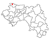
 Koundara Location in Guinea | |
| Coordinates: 12°29′N 13°18′W / 12.483°N 13.300°W / 12.483; -13.300 | |
| Country | |
| Region | Boké Region |
| Prefecture | Koundara Prefecture |
| Population (2014 census) | |
| • Total | 27,433 |
Koundara is a town in northwestern Guinea. It is the capital of Koundara Prefecture. The town is served by Sambailo Airport. As of 2014 it had a population of 27,433 people.[1]
Climate
Koundara has a tropical savanna climate (Köppen climate classification Aw).
| Climate data for Koundara | |||||||||||||
|---|---|---|---|---|---|---|---|---|---|---|---|---|---|
| Month | Jan | Feb | Mar | Apr | May | Jun | Jul | Aug | Sep | Oct | Nov | Dec | Year |
| Average high °C (°F) | 34.2 (93.6) | 36.5 (97.7) | 38.4 (101.1) | 39.3 (102.7) | 38.1 (100.6) | 33.9 (93.0) | 31.1 (88.0) | 30.6 (87.1) | 31.2 (88.2) | 32.3 (90.1) | 33.3 (91.9) | 33.7 (92.7) | 34.4 (93.9) |
| Average low °C (°F) | 16.7 (62.1) | 19.4 (66.9) | 22.1 (71.8) | 24.1 (75.4) | 24.9 (76.8) | 23.6 (74.5) | 22.3 (72.1) | 22.4 (72.3) | 22.3 (72.1) | 22.7 (72.9) | 20.2 (68.4) | 15.7 (60.3) | 21.4 (70.5) |
| Average rainfall mm (inches) | 0.0 (0.0) | 0.2 (0.01) | 0.3 (0.01) | 1.8 (0.07) | 49.2 (1.94) | 137.2 (5.40) | 250.1 (9.85) | 305.1 (12.01) | 262.7 (10.34) | 82.2 (3.24) | 9.2 (0.36) | 0.1 (0.00) | 1,098.1 (43.23) |
| Average rainy days | 0 | 1 | 1 | 1 | 3 | 10 | 14 | 17 | 17 | 6 | 1 | 1 | 72 |
| Source: World Meteorological Organization[2] | |||||||||||||
References
^ "Guinea". Institut National de la Statistique, Guinea, accessed via Geohive. Archived from the original on 24 November 2015. Retrieved 27 August 2014..mw-parser-output cite.citation{font-style:inherit}.mw-parser-output .citation q{quotes:"""""""'""'"}.mw-parser-output .citation .cs1-lock-free a{background:url("//upload.wikimedia.org/wikipedia/commons/thumb/6/65/Lock-green.svg/9px-Lock-green.svg.png")no-repeat;background-position:right .1em center}.mw-parser-output .citation .cs1-lock-limited a,.mw-parser-output .citation .cs1-lock-registration a{background:url("//upload.wikimedia.org/wikipedia/commons/thumb/d/d6/Lock-gray-alt-2.svg/9px-Lock-gray-alt-2.svg.png")no-repeat;background-position:right .1em center}.mw-parser-output .citation .cs1-lock-subscription a{background:url("//upload.wikimedia.org/wikipedia/commons/thumb/a/aa/Lock-red-alt-2.svg/9px-Lock-red-alt-2.svg.png")no-repeat;background-position:right .1em center}.mw-parser-output .cs1-subscription,.mw-parser-output .cs1-registration{color:#555}.mw-parser-output .cs1-subscription span,.mw-parser-output .cs1-registration span{border-bottom:1px dotted;cursor:help}.mw-parser-output .cs1-ws-icon a{background:url("//upload.wikimedia.org/wikipedia/commons/thumb/4/4c/Wikisource-logo.svg/12px-Wikisource-logo.svg.png")no-repeat;background-position:right .1em center}.mw-parser-output code.cs1-code{color:inherit;background:inherit;border:inherit;padding:inherit}.mw-parser-output .cs1-hidden-error{display:none;font-size:100%}.mw-parser-output .cs1-visible-error{font-size:100%}.mw-parser-output .cs1-maint{display:none;color:#33aa33;margin-left:0.3em}.mw-parser-output .cs1-subscription,.mw-parser-output .cs1-registration,.mw-parser-output .cs1-format{font-size:95%}.mw-parser-output .cs1-kern-left,.mw-parser-output .cs1-kern-wl-left{padding-left:0.2em}.mw-parser-output .cs1-kern-right,.mw-parser-output .cs1-kern-wl-right{padding-right:0.2em}
^ "World Weather Information Service — Koundara". World Meteorological Organization. Retrieved October 19, 2015.
Coordinates: 12°29′N 13°18′W / 12.483°N 13.300°W / 12.483; -13.300
Capital: Koundara | ||
| Sub-prefectures |
|  |
This Guinea location article is a stub. You can help Wikipedia by expanding it. |


