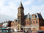
St Luke's railway station
| St Luke's | |
|---|---|
 The present-day site of St Luke's railway station. The gap between the tracks shows where the Preston platform used to stand. | |
| Location | |
| Place | Southport |
| Area | Sefton |
| Coordinates | 53°38′37″N 2°59′18″W / 53.64348°N 2.988238°W / 53.64348; -2.988238Coordinates: 53°38′37″N 2°59′18″W / 53.64348°N 2.988238°W / 53.64348; -2.988238 |
| Grid reference | SD34771678 |
| Operations | |
| Original company | Lancashire and Yorkshire Railway |
| Pre-grouping | London and North Western Railway |
| Post-grouping | London, Midland and Scottish Railway |
| Platforms | 4[1] |
| History | |
| 2 July 1883 (1883-07-02) | Opened as Barton Street[1] |
| October 1883 | Renamed Southport St Luke's Road[1] |
| 1 March 1902 | Renamed Southport St Luke's[1] |
| May 1914 | Renamed St Luke's[1] |
| 8 September 1968 | Closed[1] |
| Disused railway stations in the United Kingdom | |
| Closed railway stations in Britain A B C D–F G H–J K–L M–O P–R S T–V W–Z | |
St Luke's railway station was a railway station in Southport, Merseyside.
Contents
1 History
1.1 Decline and closure
2 References
3 External links
History
It opened by the Lancashire & Yorkshire Railway on 2 July 1883 as Barton Street, serving the route from Southport Chapel Street to Wigan. It was then renamed three months later as Southport St Luke's Road.
On 1 March 1902, the station was renamed again as Southport St Luke's, and in June of that year it began serving the Preston line, absorbing the adjacent Southport Ash Street railway station. The two platforms were almost at right angles to each other, both separated by a road named Hart Street. They did, however, share the same ticket office, located on the street at St Luke's Road.
On 22 March 1904 the Preston line was electrified all the way up to Crossens,[2] and enabled a regular service to stop at St Luke's. In May 1914, the station was finally named St Luke's.
Decline and closure
Trains to Preston (including the Crossens electric shuttle) ended when the line was closed on 7 September 1964, a victim of the Beeching Axe.[3] However the station did not close as some trains bound for Wigan still used part of the route. The direct line to Wigan then closed on 14 June 1965 with trains being diverted via Meols Cop and a section of the old branch line to Altcar to allow the closure of the busy level crossing at Blowick.[1] The end of St Luke's station came when the Preston platform, still serving a number of trains, finally closed on 9 September 1968.
Today, the site of the Wigan platforms have been built over with a modern housing development, but the tracks widen at a point where the Preston platform used to stand and can be clearly seen by passing trains.
References
^ abcdefg "Station Name: St. Lukes". Disused Stations. Retrieved 28 February 2016..mw-parser-output cite.citation{font-style:inherit}.mw-parser-output q{quotes:"""""""'""'"}.mw-parser-output code.cs1-code{color:inherit;background:inherit;border:inherit;padding:inherit}.mw-parser-output .cs1-lock-free a{background:url("//upload.wikimedia.org/wikipedia/commons/thumb/6/65/Lock-green.svg/9px-Lock-green.svg.png")no-repeat;background-position:right .1em center}.mw-parser-output .cs1-lock-limited a,.mw-parser-output .cs1-lock-registration a{background:url("//upload.wikimedia.org/wikipedia/commons/thumb/d/d6/Lock-gray-alt-2.svg/9px-Lock-gray-alt-2.svg.png")no-repeat;background-position:right .1em center}.mw-parser-output .cs1-lock-subscription a{background:url("//upload.wikimedia.org/wikipedia/commons/thumb/a/aa/Lock-red-alt-2.svg/9px-Lock-red-alt-2.svg.png")no-repeat;background-position:right .1em center}.mw-parser-output .cs1-subscription,.mw-parser-output .cs1-registration{color:#555}.mw-parser-output .cs1-subscription span,.mw-parser-output .cs1-registration span{border-bottom:1px dotted;cursor:help}.mw-parser-output .cs1-hidden-error{display:none;font-size:100%}.mw-parser-output .cs1-visible-error{font-size:100%}.mw-parser-output .cs1-subscription,.mw-parser-output .cs1-registration,.mw-parser-output .cs1-format{font-size:95%}.mw-parser-output .cs1-kern-left,.mw-parser-output .cs1-kern-wl-left{padding-left:0.2em}.mw-parser-output .cs1-kern-right,.mw-parser-output .cs1-kern-wl-right{padding-right:0.2em}
^ Marshall, p.78
^ Marshall, p.152
- Gell, Rob (1986). An Illustrated Survey of Railway Stations Between Southport & Liverpool 1848-1986. Heyday Publishing Company,
ISBN 0-947562-04-4. - Marshall, John (1981) Forgotten Railways North-West England, David & Charles (Publishers) Ltd, Newton Abbott.
ISBN 0-7153-8003-6.
External links
- Disused Stations Site Record - St. Lukes
| Preceding station | Historical railways | Following station | ||
|---|---|---|---|---|
Southport Chapel Street | | Liverpool, Southport and Preston Junction Railway | | Meols Cop |
Southport Chapel Street | | Lancashire and Yorkshire Railway Southport-Crossens electric service | | Meols Cop |
Disused railways | ||||
Southport Chapel Street | | Manchester and Southport Railway | | Blowick (until 1939) |
| | | Bescar Lane (from 1939) | ||
Southport Chapel Street | | West Lancashire Railway | | Hesketh Park |


