Saunders County, Nebraska
Saunders County, Nebraska | |
|---|---|
 Saunders County Courthouse in Wahoo | |
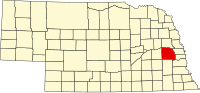 Location within the U.S. state of Nebraska | |
 Nebraska's location within the U.S. | |
| Founded | 1856 (founded as "Calhoun Co") 1858 (boundaries redefined) 1862 (renamed "Saunders Co") 1866 (organized) |
| Named for | Alvin Saunders |
| Seat | Wahoo |
| Largest city | Wahoo |
| Area | |
| • Total | 760 sq mi (1,968 km2) |
| • Land | 750 sq mi (1,942 km2) |
| • Water | 9.6 sq mi (25 km2), 1.3% |
| Population (est.) | |
| • (2017) | 21,057 |
| • Density | 26.9/sq mi (10.4/km2) |
| Congressional district | 1st |
| Time zone | Central: UTC−6/−5 |
| Website | www.saunderscounty.ne.gov |
Saunders County is a county in the U.S. state of Nebraska. As of the 2010 United States Census, the population was 20,780.[1] Its county seat is Wahoo.[2]
Saunders County is included in the Omaha-Council Bluffs, NE-IA Metropolitan Statistical Area.[3]
In the Nebraska license plate system, Saunders County is represented by the prefix 6 (the county had the sixth-largest number of vehicles registered in the state when the license plate system was established in 1922).
Contents
1 History
2 Geography
2.1 Major highways
2.2 Adjacent counties
2.3 Protected areas
3 Demographics
4 Communities
4.1 Cities
4.2 Villages
4.3 Census-designated place
4.4 Townships
5 Politics
6 See also
7 References
8 External links
History
Saunders County was established by an 1856 act of the Nebraska Territorial Legislature, and was organized in 1866;[4][5] its boundaries were redefined in 1858.[6] The county was originally named after John C. Calhoun; in 1862, during the American Civil War, it was renamed after Nebraska territorial governor Alvin Saunders.[7][8]
Geography
Saunders County is bordered on the north and east by the Platte River. Several local drainages move runoff water from the county eastward into the Platte. The county terrain is composed of low rolling hills,[9] which slope eastward and northeastward to the river valley. The county has an area of 760 square miles (2,000 km2), of which 750 square miles (1,900 km2) is land and 9.6 square miles (25 km2) (1.3%) is water.[10]
Major highways
 U.S. Highway 6
 U.S. Highway 77
 Nebraska Highway 64
 Nebraska Highway 66
 Nebraska Highway 79
 Nebraska Highway 92
 Nebraska Highway 109
Adjacent counties
Douglas County – east
Sarpy County – east
Cass County – southeast
Lancaster County – south
Butler County – west
Dodge County – north
Protected areas
- Bramble State Wildlife Management Area[11]
- Czechland Lake Recreation and Wildlife Management Area[12]
- Jack Sinn Memorial State Wildlife Management Area[13]
- Memphis Lake State Recreation Area[14]
- Pioneer State Recreation Area[15]
Demographics
| Historical population | |||
|---|---|---|---|
| Census | Pop. | %± | |
| 1870 | 4,547 | — | |
| 1880 | 15,810 | 247.7% | |
| 1890 | 21,577 | 36.5% | |
| 1900 | 22,085 | 2.4% | |
| 1910 | 21,179 | −4.1% | |
| 1920 | 20,589 | −2.8% | |
| 1930 | 20,167 | −2.0% | |
| 1940 | 17,892 | −11.3% | |
| 1950 | 16,923 | −5.4% | |
| 1960 | 17,270 | 2.1% | |
| 1970 | 17,018 | −1.5% | |
| 1980 | 18,716 | 10.0% | |
| 1990 | 18,285 | −2.3% | |
| 2000 | 19,830 | 8.4% | |
| 2010 | 20,780 | 4.8% | |
| Est. 2017 | 21,057 | [16] | 1.3% |
| US Decennial Census[17] 1790-1960[18] 1900-1990[19] 1990-2000[20] 2010-2013[1] | |||
As of the 2000 United States Census,[21], there were 19,830 people, 7,498 households, and 5,443 families in the county. The population density was 26 people per square mile (10/km²). There were 8,266 housing units at an average density of 11 per square mile (4/km²). The racial makeup of the county was 98.49% White, 0.11% Black or African American, 0.29% Native American, 0.22% Asian, 0.01% Pacific Islander, 0.35% from other races, and 0.55% from two or more races. 1.03% of the population were Hispanic or Latino of any race.
There were 7,498 households out of which 34.20% had children under the age of 18 living with them, 62.60% were married couples living together, 6.70% had a female householder with no husband present, and 27.40% were non-families. 23.60% of all households were made up of individuals and 11.90% had someone living alone who was 65 years of age or older. The average household size was 2.61 and the average family size was 3.11.
The county population contained 27.90% under the age of 18, 6.30% from 18 to 24, 27.60% from 25 to 44, 22.90% from 45 to 64, and 15.30% who were 65 years of age or older. The median age was 38 years. For every 100 females there were 99.10 males. For every 100 females age 18 and over, there were 98.10 males.
The median income for a household in the county was $42,173, and the median income for a family was $49,443. Males had a median income of $33,309 versus $22,922 for females. The per capita income for the county was $18,392. About 5.30% of families and 6.60% of the population were below the poverty line, including 7.30% of those under age 18 and 7.00% of those age 65 or over.
Communities
Cities
- Ashland
Wahoo (county seat)- Yutan
Villages
- Cedar Bluffs
- Ceresco
- Colon
- Ithaca
- Leshara
- Malmo
- Mead
- Memphis
- Morse Bluff
- Prague
- Valparaiso
- Weston

Historic schoolhouse in Saunders County
Census-designated place
- Wann
Townships
- Ashland
- Bohemia
- Center
- Chapman
- Chester
- Clear Creek
- Douglas
- Elk
- Green
- Leshara
- Marble
- Marietta
- Mariposa
- Morse Bluff
- Newman
- North Cedar
- Oak Creek
- Pohocco
- Richland
- Rock Creek
- South Cedar
- Stocking
- Union
- Wahoo
Politics
Saunders County voters tend to vote Republican. In only two national elections since 1936 has the county selected the Democratic Party candidate (as of 2016)
| Year | Republican | Democratic | Third Parties |
|---|---|---|---|
2016 | 69.6% 7,555 | 23.2% 2,523 | 7.2% 782 |
2012 | 65.7% 6,770 | 32.1% 3,307 | 2.3% 235 |
2008 | 60.6% 6,188 | 36.9% 3,767 | 2.5% 257 |
2004 | 67.9% 6,441 | 30.4% 2,884 | 1.7% 164 |
2000 | 63.8% 5,688 | 32.0% 2,852 | 4.3% 379 |
1996 | 52.5% 4,514 | 32.3% 2,777 | 15.2% 1,306 |
1992 | 44.1% 4,037 | 27.4% 2,509 | 28.5% 2,606 |
1988 | 55.5% 4,459 | 43.9% 3,526 | 0.7% 55 |
1984 | 67.3% 5,217 | 31.8% 2,467 | 0.8% 63 |
1980 | 66.1% 5,223 | 25.7% 2,034 | 8.2% 649 |
1976 | 51.2% 3,844 | 46.8% 3,507 | 2.0% 151 |
1972 | 63.1% 4,282 | 36.9% 2,501 | |
1968 | 57.4% 3,429 | 33.3% 1,990 | 9.3% 556 |
1964 | 44.5% 3,345 | 55.5% 4,172 | |
1960 | 56.9% 4,702 | 43.1% 3,556 | |
1956 | 59.9% 4,973 | 40.1% 3,335 | |
1952 | 65.1% 5,525 | 34.9% 2,962 | |
1948 | 47.9% 3,660 | 52.1% 3,979 | |
1944 | 61.2% 6,615 | 38.8% 4,199 | |
1940 | 54.2% 4,917 | 45.8% 4,162 | |
1936 | 39.4% 3,773 | 57.5% 5,514 | 3.1% 300 |
1932 | 30.4% 2,772 | 67.2% 6,134 | 2.5% 228 |
1928 | 58.3% 5,356 | 41.3% 3,793 | 0.4% 37 |
1924 | 45.2% 3,499 | 36.4% 2,823 | 18.4% 1,427 |
1920 | 60.0% 3,733 | 36.9% 2,296 | 3.1% 194 |
1916 | 40.8% 1,957 | 55.7% 2,671 | 3.4% 165 |
1912 | 18.8% 864 | 45.2% 2,080 | 36.0% 1,655 |
1908 | 45.2% 2,309 | 52.4% 2,679 | 2.4% 123 |
1904 | 60.1% 2,880 | 22.8% 1,091 | 17.1% 818 |
1900 | 44.8% 2,325 | 53.3% 2,762 | 1.9% 100 |
See also
- National Register of Historic Places listings in Saunders County, Nebraska
References
^ ab "State & County QuickFacts". United States Census Bureau. Retrieved September 22, 2013..mw-parser-output cite.citation{font-style:inherit}.mw-parser-output .citation q{quotes:"""""""'""'"}.mw-parser-output .citation .cs1-lock-free a{background:url("//upload.wikimedia.org/wikipedia/commons/thumb/6/65/Lock-green.svg/9px-Lock-green.svg.png")no-repeat;background-position:right .1em center}.mw-parser-output .citation .cs1-lock-limited a,.mw-parser-output .citation .cs1-lock-registration a{background:url("//upload.wikimedia.org/wikipedia/commons/thumb/d/d6/Lock-gray-alt-2.svg/9px-Lock-gray-alt-2.svg.png")no-repeat;background-position:right .1em center}.mw-parser-output .citation .cs1-lock-subscription a{background:url("//upload.wikimedia.org/wikipedia/commons/thumb/a/aa/Lock-red-alt-2.svg/9px-Lock-red-alt-2.svg.png")no-repeat;background-position:right .1em center}.mw-parser-output .cs1-subscription,.mw-parser-output .cs1-registration{color:#555}.mw-parser-output .cs1-subscription span,.mw-parser-output .cs1-registration span{border-bottom:1px dotted;cursor:help}.mw-parser-output .cs1-ws-icon a{background:url("//upload.wikimedia.org/wikipedia/commons/thumb/4/4c/Wikisource-logo.svg/12px-Wikisource-logo.svg.png")no-repeat;background-position:right .1em center}.mw-parser-output code.cs1-code{color:inherit;background:inherit;border:inherit;padding:inherit}.mw-parser-output .cs1-hidden-error{display:none;font-size:100%}.mw-parser-output .cs1-visible-error{font-size:100%}.mw-parser-output .cs1-maint{display:none;color:#33aa33;margin-left:0.3em}.mw-parser-output .cs1-subscription,.mw-parser-output .cs1-registration,.mw-parser-output .cs1-format{font-size:95%}.mw-parser-output .cs1-kern-left,.mw-parser-output .cs1-kern-wl-left{padding-left:0.2em}.mw-parser-output .cs1-kern-right,.mw-parser-output .cs1-kern-wl-right{padding-right:0.2em}
^ "Find a County". National Association of Counties. Retrieved 7 June 2011.
^ United States Office of Management and Budget. "Update of Statistical Area Definitions and Guidance on Their Uses" (PDF). pp. 5, 36. Archived from the original (PDF) on 14 May 2006. Retrieved 21 July 2006.
^ "Nebraska Historic Buildings Survey Saunders County" (PDF). Nebraska State Historical Society. August 2003. Retrieved December 19, 2014.
^ Andreas, A. T. (1882). "Andreas' History of the State of Nebraska". The Kansas Collection. Retrieved December 19, 2014.
^ Fitzpatrick, Lilian Linder (1925). Nebraska Place-Names. Lincoln: University of Nebraska Studies in Language, Literature, and Criticism. p. 125. Retrieved December 19, 2014.
^ Fitzpatrick, Lilian Linder (1925). "Nebraska Place-Names". University of Nebraska Department of English. Retrieved 27 September 2011.
^ "Nebraska Historic Buildings Survey - Saunders County". Nebraska State Historical Society. Retrieved 27 September 2011.
^ Saunders County NE Google Maps (accessed 26 January 2019)
^ "2010 Census Gazetteer Files". US Census Bureau. August 22, 2012. Archived from the original on November 13, 2013. Retrieved December 11, 2014.
^ Bramble State Wildlife Management Area, Morse Bluff NE Google Maps (accessed 26 January 2019)
^ Czechland Lake Recreation and Wldlf Mgt Area, Prague NE Google Maps (accessed 26 January 2019)
^ Jack Sinn Memorial State Wildlife Management Area, Ceresco NE Google Maps (accessed 26 January 2019)
^ Memphis Lake State Recreation Area Google Maps (accessed 26 January 2019)
^ Pioneer State Recreation Area, Wahoo NE Google Maps (accessed 26 January 2019)
^ "Population and Housing Unit Estimates". Retrieved 21 January 2019.
^ "US Decennial Census". US Census Bureau. Retrieved December 11, 2014.
^ "Historical Census Browser". University of Virginia Library. Retrieved December 11, 2014.
^ "Population of Counties by Decennial Census: 1900 to 1990". US Census Bureau. Retrieved December 11, 2014.
^ "Census 2000 PHC-T-4. Ranking Tables for Counties: 1990 and 2000" (PDF). US Census Bureau. Retrieved December 11, 2014.
^ "American FactFinder". US Census Bureau]]. Retrieved 31 January 2008.
^ Election Results
External links
- Saunders County (by Nebraska Rural Web)
- Saunders County Government (website)
- Mead and Hunt. (2003) Nebraska Historic Buildings Survey: Saunders County. Nebraska State Historical Society. Retrieved 8/30/07.
Places adjacent to Saunders County, Nebraska | ||||||||||
|---|---|---|---|---|---|---|---|---|---|---|
| ||||||||||
Municipalities and communities of Saunders County, Nebraska, United States | ||
|---|---|---|
County seat: Wahoo | ||
| Cities |
| |
| Villages |
| |
| Townships |
| |
| CDP |
| |
| Unincorporated communities |
| |
Lincoln (capital) | ||
| Topics |
|  Seal of Nebraska |
| Society |
| |
| Regions |
| |
| Largest cities |
| |
| Counties |
| |
Metropolitan area of Omaha–Council Bluffs | ||||||
|---|---|---|---|---|---|---|
| Primary cities |
|  | ||||
| Cities over 10,000 (per 2010 Census) |
| |||||
| Cities of 5,000 to 10,000 (per 2010 Census) |
| |||||
| Cities of 1,000 to 5,000 (per 2010 Census) |
| |||||
| Census-designated places |
| |||||
| Cities and villages of fewer than 1,000 (per 2010 Census) |
| |||||
| Counties |
| |||||
Coordinates: 41°14′N 96°38′W / 41.23°N 96.63°W / 41.23; -96.63


