Arlington, New York
Arlington, New York | |
|---|---|
Census-designated place | |
 Main Street, seen from top of hill at Church of the Holy Trinity | |
 Location of Arlington, New York | |
| Coordinates: 41°41′42″N 73°53′31″W / 41.69500°N 73.89194°W / 41.69500; -73.89194Coordinates: 41°41′42″N 73°53′31″W / 41.69500°N 73.89194°W / 41.69500; -73.89194 | |
| Country | United States |
| State | New York |
| County | Dutchess |
| Town | Poughkeepsie |
| Area | |
| • Total | 0.67 sq mi (1.73 km2) |
| • Land | 0.67 sq mi (1.73 km2) |
| • Water | 0.0 sq mi (0.0 km2) |
| Elevation | 187 ft (57 m) |
| Population (2010) | |
| • Total | 4,061 |
| • Density | 6,082/sq mi (2,348.4/km2) |
| Time zone | UTC-5 (Eastern (EST)) |
| • Summer (DST) | UTC-4 (EDT) |
| ZIP code | 12603 |
| Area code(s) | 845 |
| FIPS code | 36-02616 |
GNIS feature ID | 0942561 |
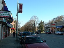
Raymond Avenue in Arlington
Arlington is a community and census-designated place (CDP) in Dutchess County, New York, United States. At the 2010 census, the CDP population was 4,061.[1]
Arlington is in the town of Poughkeepsie and is a suburb of the neighboring city of Poughkeepsie. It is part of the Poughkeepsie–Newburgh–Middletown, NY Metropolitan Statistical Area as well as the larger New York–Newark–Bridgeport, NY-NJ-CT-PA Combined Statistical Area.
Contents
1 Geography
2 Demographics
3 See also
4 References
5 External links
Geography
Arlington is located at 41°41′42″N 73°53′31″W / 41.69500°N 73.89194°W / 41.69500; -73.89194 (41.694943, -73.892054),[2] in the north-central part of the town of Poughkeepsie. It is bordered to the west by the city of Poughkeepsie.
According to the United States Census Bureau, the CDP has a total area of 0.66 square miles (1.7 km2), all of it land.[1]
Demographics
At the 2010 census, there were 4,061 people, 1,222 households and 721 families residing in the CDP. The population density was 6,061.2 per square mile (2,348.4/km²). There were 1,339 housing units at an average density of 1,998.5/sq mi (774.0/km²). The racial makeup of the CDP was 63.4% White, 16.4% African American, 0.9% Native American, 8.1% Asian, 5.4% some other race, and 5.9% from two or more races. Hispanic or Latino of any race were 14.1% of the population.[3]
There were 1,222 households, of which 33.5% had children under the age of 18 living with them, 37.3% were headed by married couples living together, 16.0% had a female householder with no husband present, and 41.0% were non-families. 34.6% of all households were made up of individuals, and 10.3% were someone living alone who was 65 years of age or older. The average household size was 2.43, and the average family size was 3.19.[3]
18.6% of the population were under the age of 18, 34.2% from 18 to 24, 21.0% from 25 to 44, 18.5% from 45 to 64, and 7.9% who were 65 years of age or older. The median age was 22.9 years. For every 100 females, there were 83.3 males. For every 100 females age 18 and over, there were 80.6 males.[3]
For the period 2009 through 2013, the estimated median household income was $41,679, and the median family income was $56,250. Male full-time workers had a median income of $41,617 and females $35,459. The per capita income was $21,123. About 11.6% of families and 19.1% of the population were below the poverty line, including 21.5% of those under age 18 and 22.7% of those age 65 or over.[4]
Part of the campus of Vassar College is in the CDP.
See also
- Arlington Fire District
References
^ ab "Geographic Identifiers: 2010 Demographic Profile Data (G001): Arlington CDP, New York". U.S. Census Bureau, American Factfinder. Retrieved November 18, 2015..mw-parser-output cite.citation{font-style:inherit}.mw-parser-output .citation q{quotes:"""""""'""'"}.mw-parser-output .citation .cs1-lock-free a{background:url("//upload.wikimedia.org/wikipedia/commons/thumb/6/65/Lock-green.svg/9px-Lock-green.svg.png")no-repeat;background-position:right .1em center}.mw-parser-output .citation .cs1-lock-limited a,.mw-parser-output .citation .cs1-lock-registration a{background:url("//upload.wikimedia.org/wikipedia/commons/thumb/d/d6/Lock-gray-alt-2.svg/9px-Lock-gray-alt-2.svg.png")no-repeat;background-position:right .1em center}.mw-parser-output .citation .cs1-lock-subscription a{background:url("//upload.wikimedia.org/wikipedia/commons/thumb/a/aa/Lock-red-alt-2.svg/9px-Lock-red-alt-2.svg.png")no-repeat;background-position:right .1em center}.mw-parser-output .cs1-subscription,.mw-parser-output .cs1-registration{color:#555}.mw-parser-output .cs1-subscription span,.mw-parser-output .cs1-registration span{border-bottom:1px dotted;cursor:help}.mw-parser-output .cs1-ws-icon a{background:url("//upload.wikimedia.org/wikipedia/commons/thumb/4/4c/Wikisource-logo.svg/12px-Wikisource-logo.svg.png")no-repeat;background-position:right .1em center}.mw-parser-output code.cs1-code{color:inherit;background:inherit;border:inherit;padding:inherit}.mw-parser-output .cs1-hidden-error{display:none;font-size:100%}.mw-parser-output .cs1-visible-error{font-size:100%}.mw-parser-output .cs1-maint{display:none;color:#33aa33;margin-left:0.3em}.mw-parser-output .cs1-subscription,.mw-parser-output .cs1-registration,.mw-parser-output .cs1-format{font-size:95%}.mw-parser-output .cs1-kern-left,.mw-parser-output .cs1-kern-wl-left{padding-left:0.2em}.mw-parser-output .cs1-kern-right,.mw-parser-output .cs1-kern-wl-right{padding-right:0.2em}
^ "US Gazetteer files: 2010, 2000, and 1990". United States Census Bureau. February 12, 2011. Retrieved April 23, 2011.
^ abc "Profile of General Population and Housing Characteristics: 2010 Census Summary File 1 (DP-1): Arlington CDP, New York". U.S. Census Bureau, American Factfinder. Retrieved November 18, 2015.
^ "Selected Economic Characteristics: 2009-2013 American Community Survey 5-Year Estimates (DP03): Arlington CDP, New York". U.S. Census Bureau, American Factfinder. Retrieved November 18, 2015.
External links
- Poughkeepsie Public Library District
Albany (capital) | ||
| Topics |
|  |
| Politics |
| |
| Regions |
| |
| Metro areas |
| |
| Counties |
| |
| Places |
| |
Municipalities and communities of Dutchess County, New York, United States | ||
|---|---|---|
County seat: Poughkeepsie | ||
| Cities |
|  |
| Towns |
| |
| Villages |
| |
| CDPs |
| |
| Other hamlets |
| |
| Footnotes | ‡This populated place also has portions in an adjacent county or counties | |


