劳埃德明斯特
| 劳埃德明斯特 | |
|---|---|
市 | |
City of Lloydminster | |
 劳埃德明斯特市内的省界标识 | |
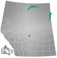 所在位置 | |
坐标:53°17′N 110°00′W / 53.28°N 110°W / 53.28; -110 | |
| 国家 | 加拿大 |
| 省 | 艾伯塔省 萨斯喀彻温省 |
| 地区 | 中艾伯塔, 中西萨斯喀彻温 |
| 人口普查分区 | 艾伯塔省第10分区, 萨斯喀彻温省第17分区 |
| 合并前 [1] 建置 - 村(萨省) - 村(艾省) - 镇(萨省) | 1903年11月25日 (当时属于西北地区) 1906年7月6日 1907年4月1日 |
| 合并 [1] - 镇 | 1930年5月22日 |
| 合并后. [1] 建置 - 市 | 1958年1月1日 |
| 面积 (2011) | |
| • 市 | 41.53 平方公里(16.03 平方英里) |
| 海拔[2] | 645 米(2,116 英尺) |
| 人口(2011)[3] | |
| • 市 | 27,804 |
| • 密度 | 669.5/平方公里(1,734/平方英里) |
| • 市区 | 27,804 |
| 时区 | 北美山地时间 (UTC-7) |
| • 夏时制 | 山地夏令时间(UTC-6) |
| 網站 | 官方网站 |
劳埃德明斯特(英语:Lloydminster),加拿大城市,位于艾伯塔省与萨斯喀彻温省两省省界之上。虽然该市地跨两省,但在市政管理上作为一个城市。 总面积41.53平方公里,其中艾伯塔省部分24.19平方公里,萨斯喀彻温省部分13.34平方公里。总人口2 7804(2011年),其中艾伯塔省部分1 8032,萨斯喀彻温省部分9772。
参考文献
^ 1.01.11.2 Alberta Municipal Affairs. Municipal Profile – City of Lloydminster. 2010-09-17 [2010-10-02].
^ Alberta Private Sewage Systems 2009 Standard of Practice Handbook: Appendix A.3 Alberta Design Data (A.3.A. Alberta Climate Design Data by Town) (PDF) (PDF). Safety Codes Council: 212–215 (PDF pages 226–229). January 2012 [October 8, 2013].
^ Population and dwelling counts, for Canada, provinces and territories, and population centres, 2011 and 2006 censuses (Alberta). Statistics Canada. 2013-01-30 [2013-03-17].


