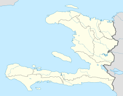
Port-de-Paix (Haitian Creole: Pòdepè or Pòdpè English: Port of Peace) is a commune and the capital of the Nord-Ouest department of Haiti on the Atlantic coast. It has a population of 462,000 (2015 census IHSI). Port-de-Paix used to be a large exporter of bananas and coffee.[1]
Contents
1History
2Transportation
3Notable people
4Media
4.1Radio
5References
History
During the Amerindian period this area was called "Xarama" by the Taïno people. The area around the town was given the name "Valparaíso" by Christopher Columbus after landing here in the late evening of December 6, 1492, and today still contains many attractive beaches and cave locations. A ferry operates between the town and Tortuga island, (La Tortue), called "Gusaeni Cahini" by the Taïnos, which is situated just across the water.
The town was founded in 1665 by French filibusters, driven from Tortuga Island by the British occupiers. In 1676 the capital of the French Colony of Saint-Domingue was moved from Tortuga to Port-de-Paix, and it remained the seat of government until 1711 when the capital was moved to Cap-Français. In 1676, Padrejean escaped from slavery in the Port. In 1679 the town saw the first black slave revolt. The area saw great success during the 18th century but on February 27, 1903 the town was almost entirely destroyed by fire, and never attained its former status.[2]
Port-de-Paix is also the chief town of an arrondissement of the same name. The arrondissement consists of five communes: Port-de-Paix, La Pointe des Palmistes, Bassin-Bleu, Chansolme and Tortuga.
Port-de-Paix was hit by an earthquake recently, too. It was a magnitude 5.9.
Transportation
Port-de-Paix is served by Port-de-Paix Airport.
Notable people
Eliezer Cadet
Kervens Michel
Jean Ely Joseph
James Aimable
Media
Le Novateur
Radio
Radio Toxic FM 91.3
Radio Télé diffusion du Nord-Ouest (RTNO)92.5 & ch.6
Radio Balade FM 102.3 MHz
Radio Melodie Inter 98.3
Radio New Star 104.1
Radio Planète FM 100.7
Radio Télé Universelle Plus (TRUP)103.5 FM & Ch.10
Radio Voix Eglise Bethanie 94.3 FM
Radio Voix de la Paix 94.7 FM
Radio Harmonie Inter 101.5 Fm Stereo http://www.radioharmonieinter.com
Radio Couleur FM 93.9 FM Stereo
Radio Télé Ideal Plus 89.7 ch.40
Radio Castro Inter 97.1
Radio Excel Inter 106.7
Radio Dary FM 97.5
Radio Paismesbrebis 93.5
Radio natal 96.7
Radio Cosmos Inter 101.1
Radio Perfection 105.7
Radio Clean FM 95.1
Radio SD 105.1 Fm http://www.radiotelesdfm.com
Radio 102.7
Radio capoix FM 106.3
Radio Generation 80 FM 89.9
Radio Tele Port-de-Paix 88.3
Radio magnitude fm 98.7
Radio expression FM 98.9
Radio union plus 92.1
Radio omega 91.9
Radio H plus 104.9
Radio Tele Port-de-Paix 88.3
References
^Port-de-Paix - Britannica Online Encyclopedia
^FIRE DESTROYS PORT DE PAIX.; Haitian Maritime Town Burned on Thursday ... - Article Preview - The New York Times
Authority control
BNF: cb152058029 (data)
GND: 7697917-9
NARA: 10037330
VIAF: 157257739
WorldCat Identities (via VIAF): 157257739
v
t
e
Departments, arrondissements and communes of Haiti
This article is about the letter of the alphabet. For other uses, see Y (disambiguation). See also: Wye (disambiguation) Y Y y (See below) Usage Writing system Latin script Type Alphabetic and Logographic Language of origin Latin language Phonetic usage [ y ] [ ɨ ] [ j ] [ iː ] [ ɪ ] [ ɘ ] [ ə ] [ ɯ ] [ ɛː ] [ j ] [ ɥ ] [ ɣ̟ ] / w aɪ / / aɪ / Unicode value U+0059, U+0079 Alphabetical position 25 History Development Υ υ 𐌖 Y y Time period 54 to present Descendants • U • V • W • Ỿ • ¥ • Ꮙ • Ꮍ • Ꭹ Sisters F Ѵ У Ў Ұ Ү ו و ܘ וּ וֹ ࠅ 𐎆 𐡅 ወ વ ૂ ુ उ Variations (See below) Other Other letters commonly used with y(x), ly, ny This article contains IPA phonetic symbols. Without proper rendering support, you may see question marks, boxes, or other symbols instead of Unicode characters. For an introductory guide on IPA symbols, see Help:IPA. ISO basic Latin alphabet Aa Bb Cc D...
Mount Tamalpais Mount Tamalpais, viewed from the south Highest point Elevation 2,571 ft (784 m) NAVD 88 [1] Prominence 2,456 ft (749 m) [1] Listing California county high points 55th Coordinates 37°55′45″N 122°34′40″W / 37.929088°N 122.577829°W / 37.929088; -122.577829 Coordinates: 37°55′45″N 122°34′40″W / 37.929088°N 122.577829°W / 37.929088; -122.577829 [1] Geography Mount Tamalpais Marin County, California, U.S. Show map of California Mount Tamalpais Mount Tamalpais (the US) Show map of the US Parent range California Coast Ranges Topo map USGS San Rafael Geology Mountain type Sedimentary Climbing First ascent 1830s by Jacob P. Leese (first recorded ascent) [2] Easiest route Railroad Grade fire trail Mount Tamalpais ( / t æ m əl ˈ p aɪ . ɪ s / ; TAM -əl- PY -iss ; Coast Miwok: /t̪ɑmɑlˈpɑis̺/ , known locally as Mount Tam ) is a peak in Marin County, California, United State...
FMW Women's Championship Details Promotion Frontier Martial-Arts Wrestling [1] Date established November 5, 1990 [1] Date retired September 28, 1997 Other name(s) WWA World Women's Championship FMW Independent Women's Championship Statistics First champion(s) Combat Toyoda [1] Most reigns Megumi Kudo (6 reigns) [1] Longest reign Megumi Kudo (426 days) [1] Shortest reign Shark Tsuchiya (<1 day) [1] The FMW Women's Championship (or the FMW Independent Women's & WWA Women's Championship ) was two Japanese women's professional wrestling championships (WWA World Women's Championship and FMW Independent World Women's Championship) contested in the promotion Frontier Martial-Arts Wrestling (FMW). During the heyday of FMW, the female wrestlers wrestled in the same types of bloody death matches as the FMW men, and were feared by other Japanese female wrestlers for their toughness and intensity. ...